by admin | Sep 25, 2019 | Featured Posts, Greater Baton Rouge, Greater New Orleans, Most popular, North Louisiana
The words hiking and Louisiana don’t often go together. They certainly don’t conjure up images of rugged mountain trails past bubbling creeks. But if you know where to look, Louisiana offers a unique chance to get outdoors in a different way. Discover a boardwalk trail through a cypress swamp, a beautiful waterfall just over the state line or a taste of our “hill country.” Here are some of our favorite day hikes in Louisiana.
Jean Lafitte National Historical Park and Preserve and Wetland Trace
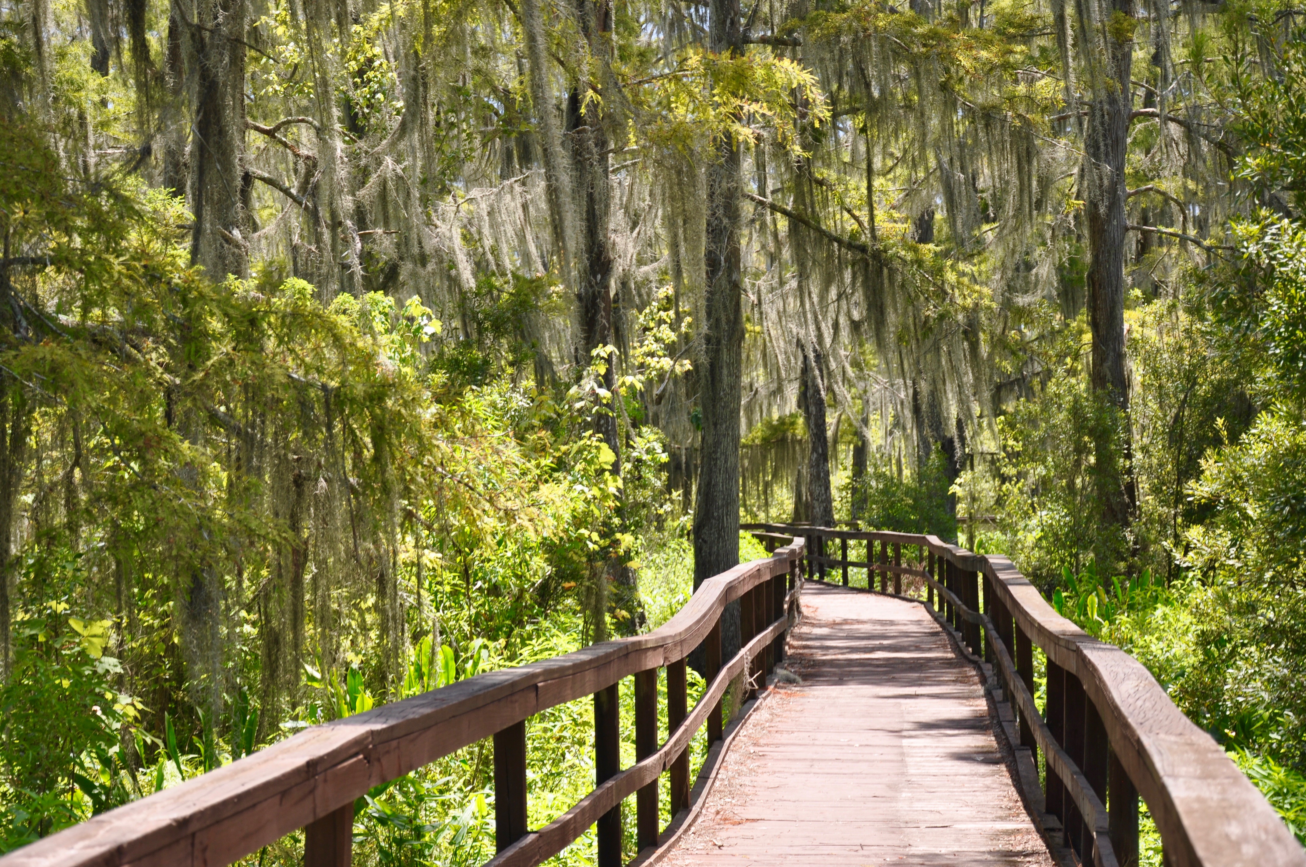
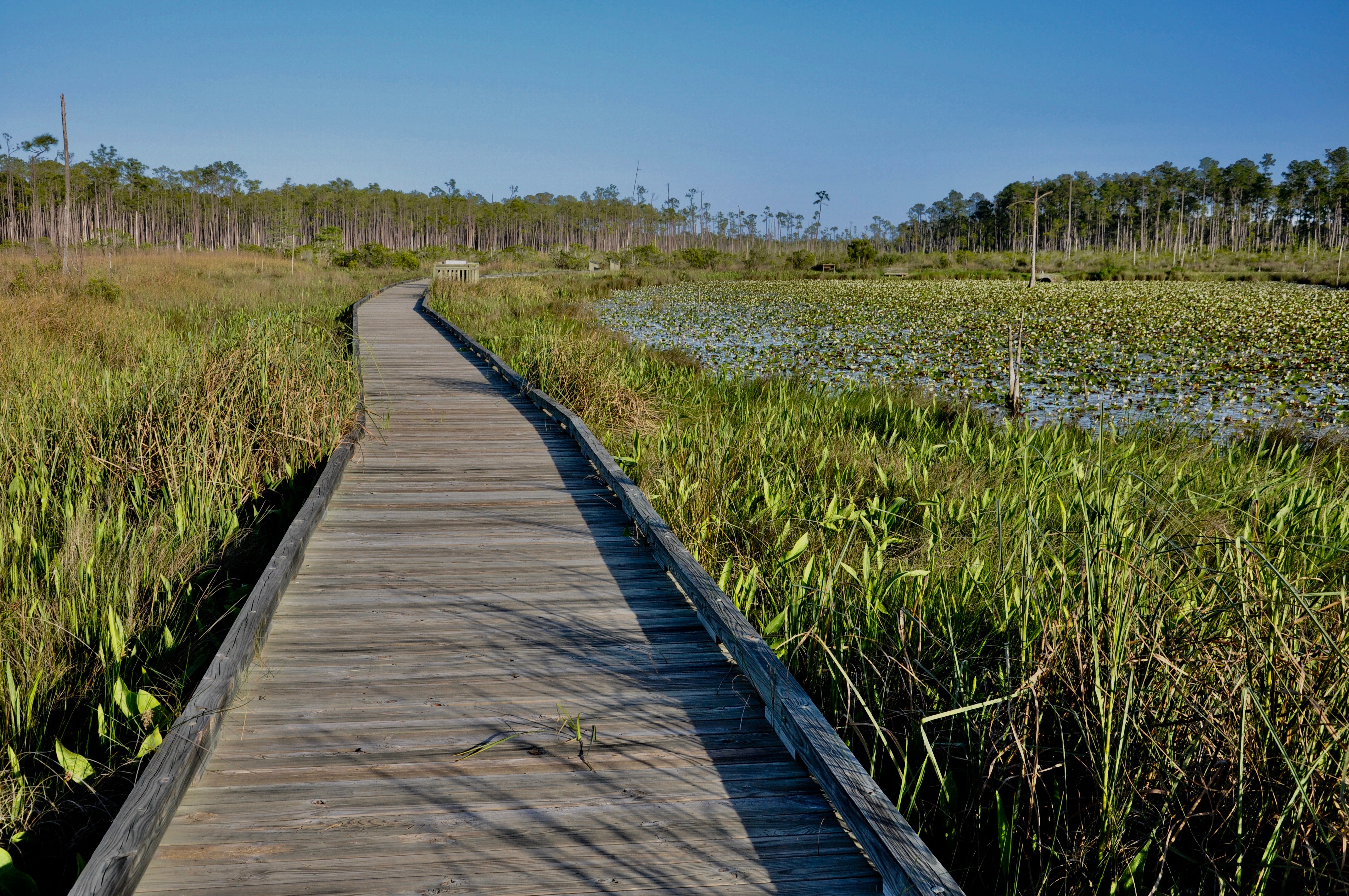
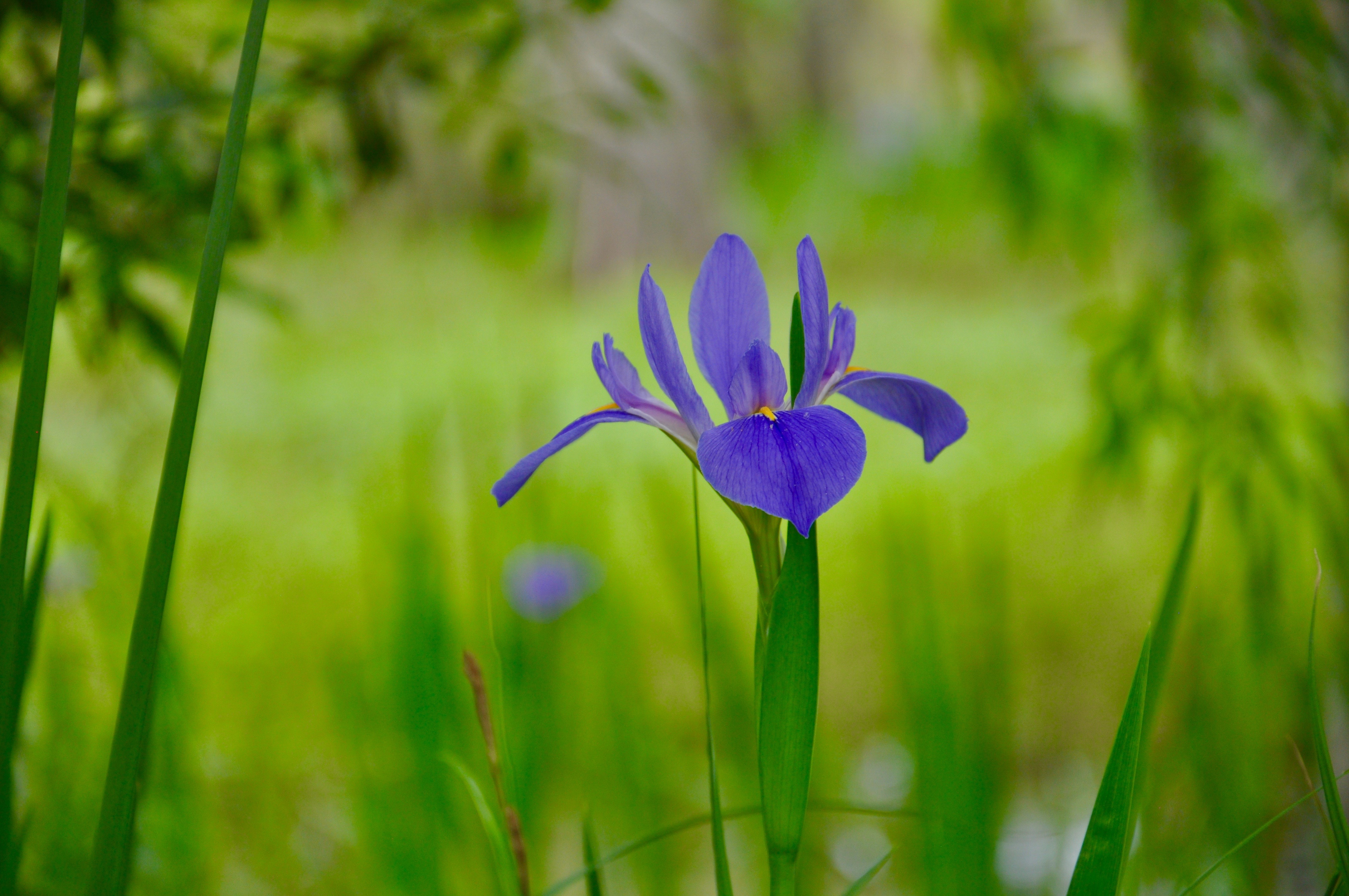
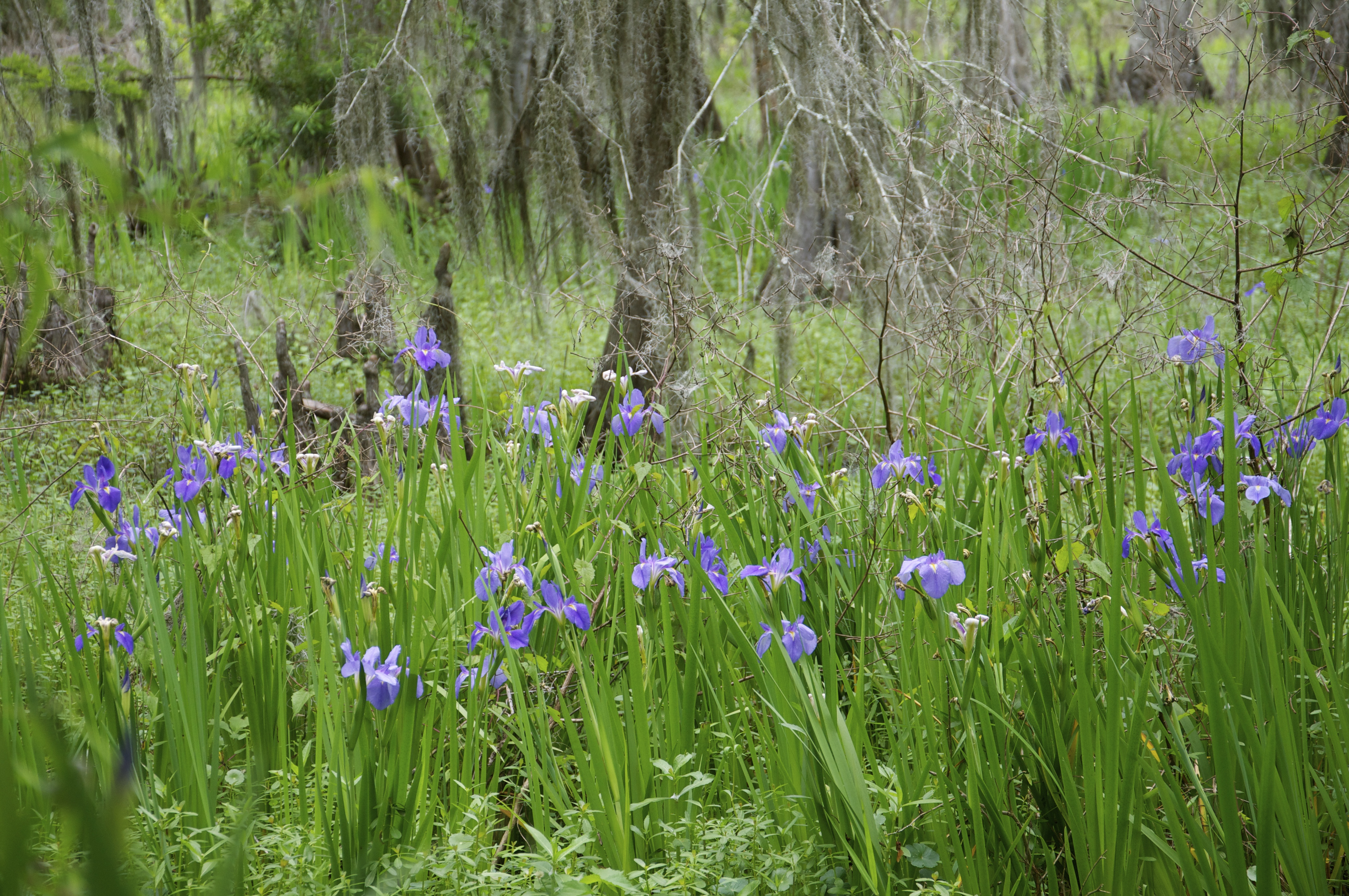
Jean Lafitte (both the park and the town) is about a half hour drive south of New Orleans. At the Barataria Preserve of Jean Lafitte National Historical Park and Preserve, walk through giant palmettos to the water’s edge, where frogs and alligators hide beneath the surface and banana spiders loom overhead. Take in another view of the swamp down the road at the Town of Jean Lafitte’s Wetland Trace. A little known gem, the trail is located behind the town’s Barataria Museum. Learn about the area’s most famous pirate – Jean Lafitte – before entering this quiet and secluded boardwalk. Look for blooming wild irises, six-foot-long snakes moseying along the boardwalk, or alligators peering silently out of the water.
Kisatchie National Forest
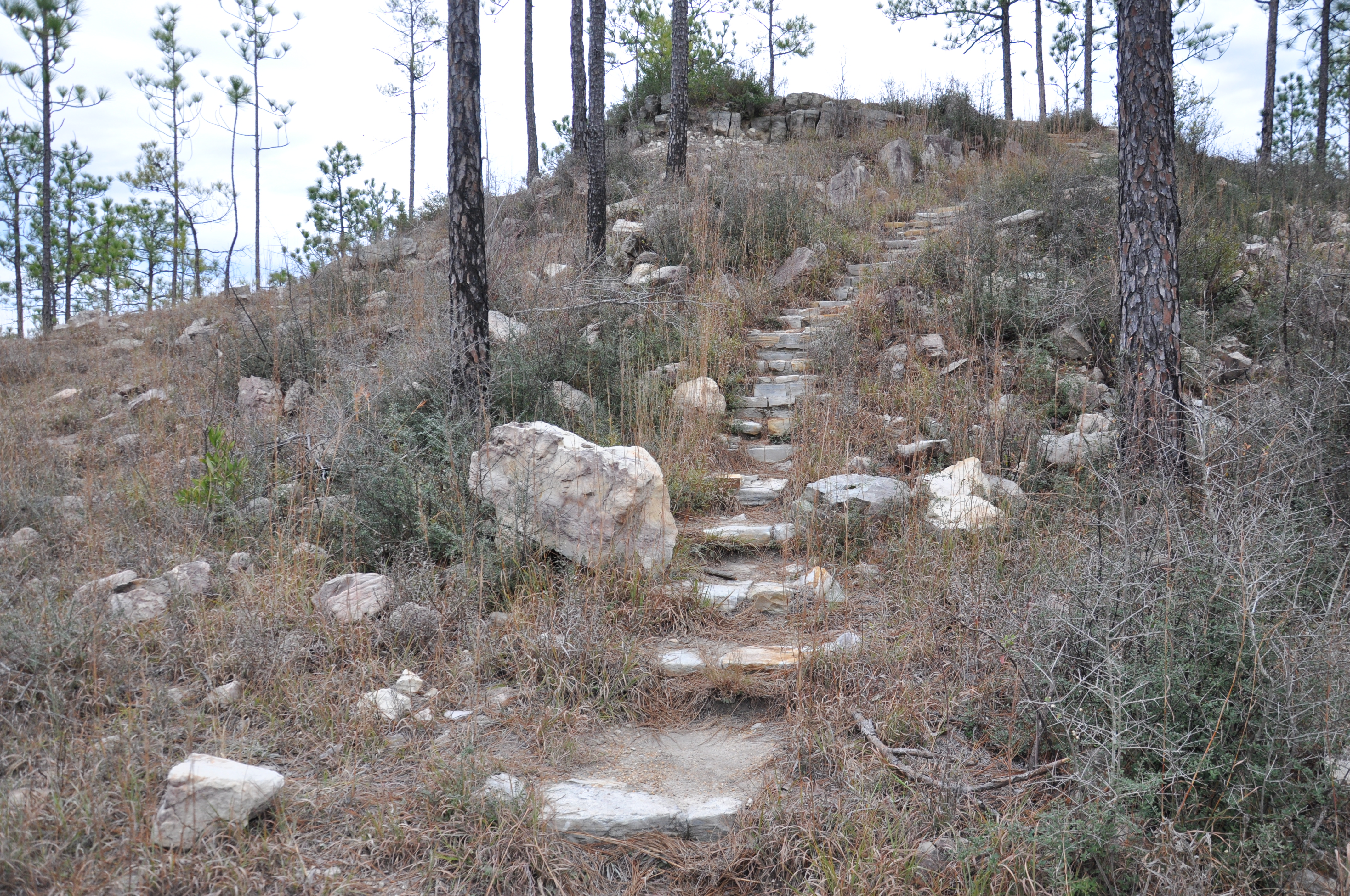 Any road trip north to Natchitoches should include a stop by Kisatchie National Forest. Divided into five districts, the forest offers an array of recreational opportunities – from hiking or biking to horseback riding or fishing. Choose from numerous trails, such as the 27-mile Wild Azalea Trail in the Calcasieu District–the longest trail in Louisiana. A perfect option for kids, though, is to drive the 17-mile Longleaf Scenic Byway and stop at the Longleaf Vista Interpretive Trail. A short stroll through bottomland hardwoods to a sandstone outcropping, the walk offers a seldom seen view of Louisiana’s “hill country.”
Clark Creek
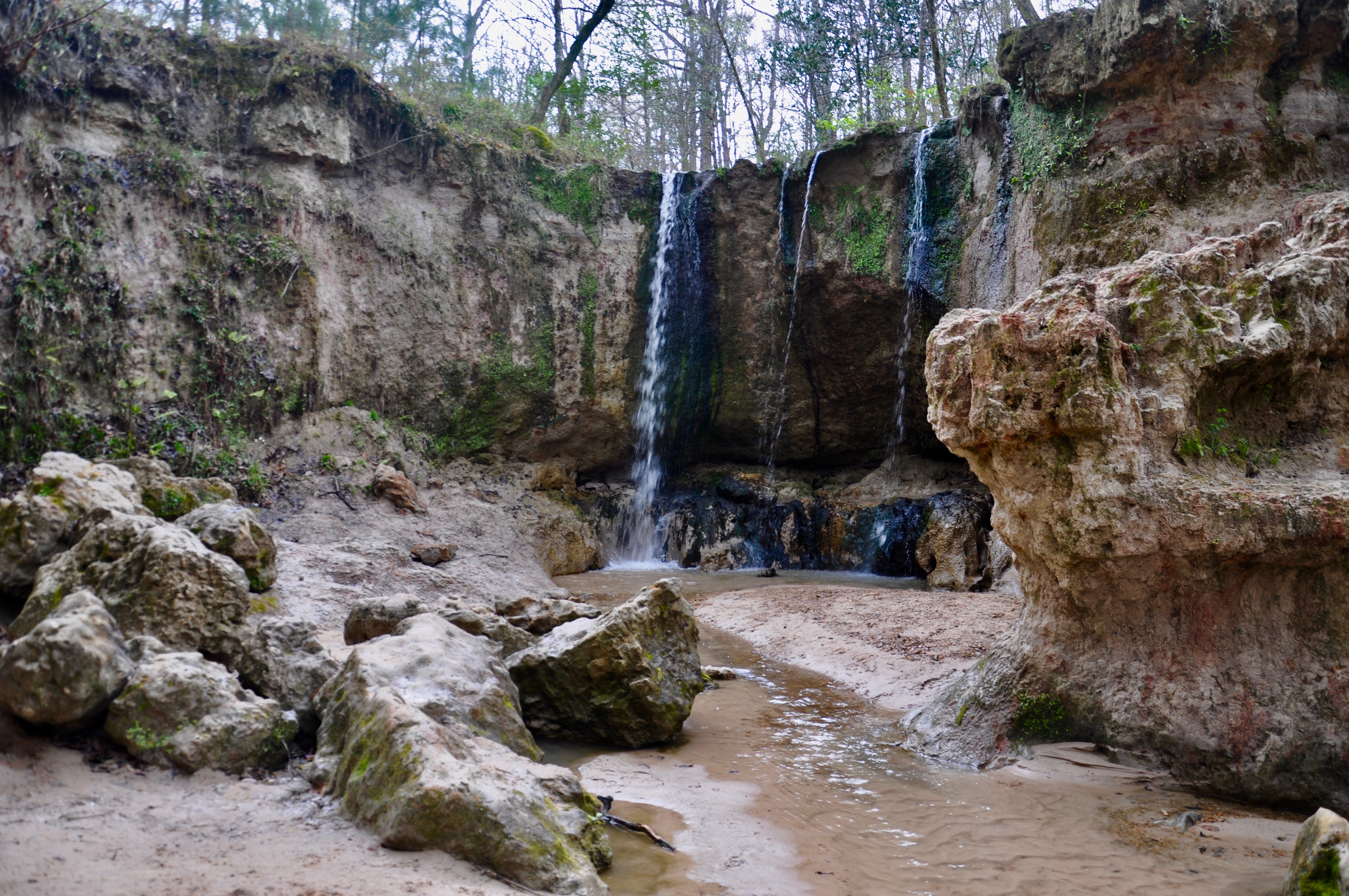 Technically in Mississippi, Clark Creek Natural Area is just across the border from St. Francisville. The trail begins along an excellent fossil hunting area and makes it way down to Clark Creek. Steep bluffs form the backdrop for the area’s waterfalls – a rare site in this part of the country. Spend the day here splashing through the creek and eating a picnic lunch by the waterfall. Be sure to carve out some time for a walk through picturesque St. Francisville on your way out.
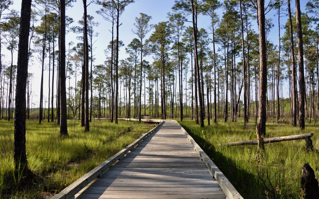
Big Branch Marsh National Wildlife Refuge
The Boy Scout Road trail at Big Branch Marsh National Wildlife Refuge takes you off the beaten path along Lake Pontchartrain’s northshore. Begin in a pine savannah leading to a half-mile interpretive trail along a boardwalk over a fresh mash. The trail then turns down a 2-mile, one-way gravel road known as Boy Scout Road. Walk through a forest to the edge of Bayou Lacombe. Years ago, schooners would sail here to carry locally made bricks across the lake to New Orleans. Don’t miss the Bayou Lacombe Visitor Center in Lacombe, featuring wildlife exhibits and trails through camellia, azalea and butterfly gardens.
Louisiana State Arboretum
The 600-acre Arboretum came to fruition because of Louisiana naturalist Caroline Dormon. Located within Chicot State Park, the Arboretum features 6 miles of trails. The Walker Branch begins near Lake Chicot at the Nature Center. It ends near the Dormon Lodge, which has an exhibit to the noted naturalist. Several spur trails break off from the Walker Branch, leading to countless interpretive signs designating various species of trees. For the more adventurous, check out the 20-mile hiking trail around Lake Chicot.
This is actually just a tip of the list. Other hikes and walks we’ve discovered on our travels include the following:
by Kristy Christiansen | Aug 29, 2019 | Beyond the State, California, Featured Posts
After traveling from San Francisco to Eureka, part two of our journey was in northern California’s redwood coast. We spent three nights in McKinleyville, just north of Eureka. This gave us two full days for exploring, and we crammed in as much as possible. Our agenda was divided pretty evenly between California’s redwoods and beaches:
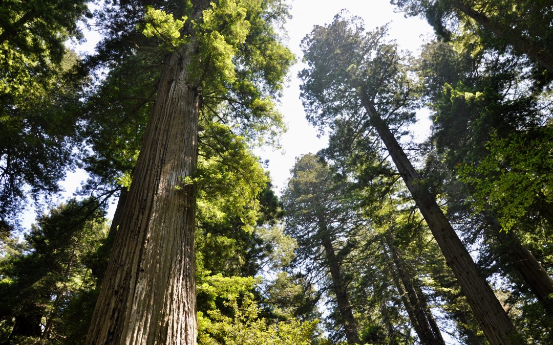
Redwoods
Redwood National and State Parks and Prairie Creek Redwoods State Park blur together on a map. Highway 101 leads through both, and other than separate visitor centers, you wouldn’t notice much of a difference. While printing our booklets for the Redwoods Junior Ranger program, I stumbled upon Redwood EdVentures. It’s more than 20 Quests in various locations throughout the Redwood coast. Each Quest has a map and a series of clues to lead you along a trail. At the end of the trail, kids look for a hidden word. When you bring the word back to the Visitor’s Center, you receive a rather nice patch that can be sewn on a backpack or jacket.
Lady Bird Johnson Trail
Just north of Orick, turn onto Bald Hills Road to access the Lady Bird Johnson trail. President Nixon dedicated the grove the First Lady in August 1969. Pick up a booklet at the trailhead to learn more about the redwoods along the interpretive trail. There are 13 numbered stops throughout the easy 1.5-mile loop. If you take your time, you’ll find lots of opportunities to step inside trees or gaze upwards at the towering heights.
Prairie Creek Trail
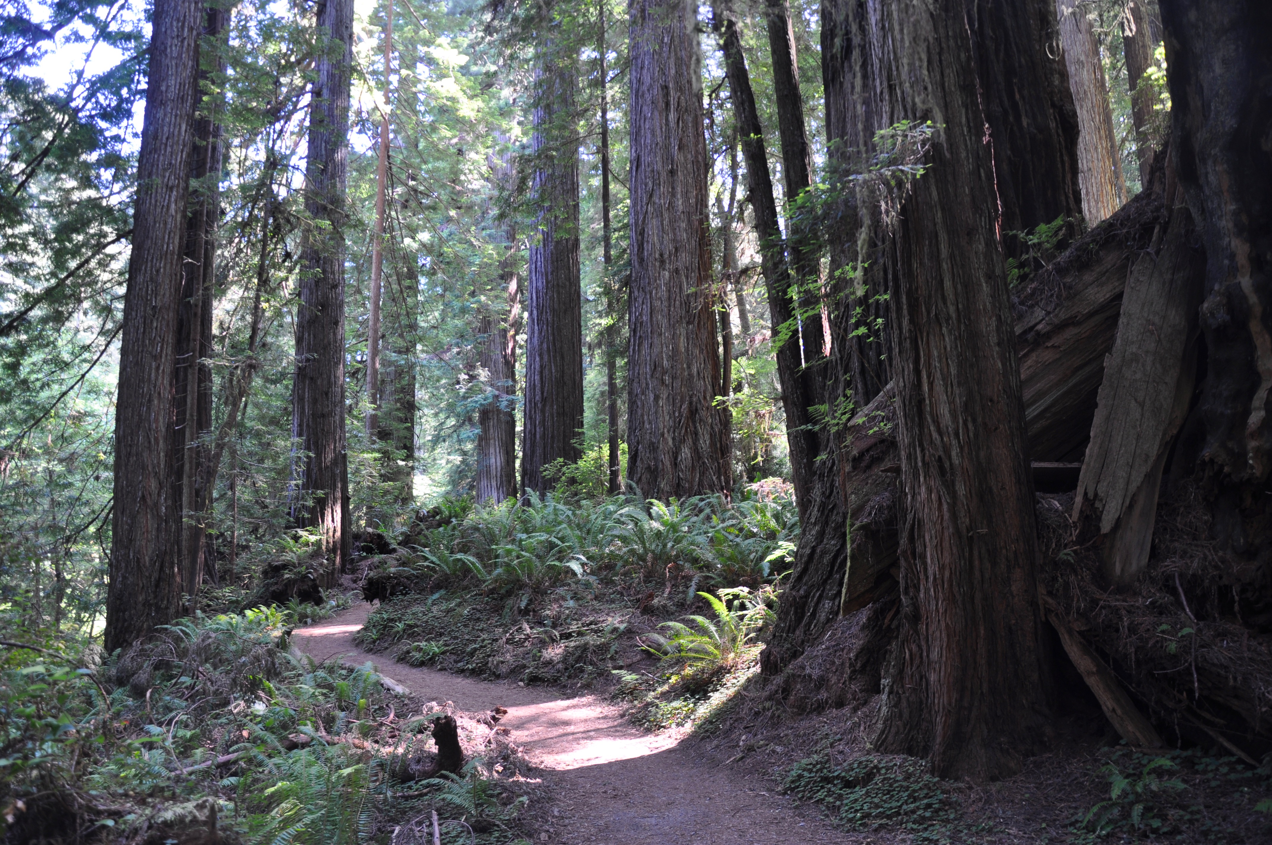
Right outside the Prairie Creek Redwoods State Park Visitor Center is the Prairie Creek trail. This is one of the sites included in the Redwood EdVentures. It’s a beautiful trail, darker and more closed in than the Lady Bird Johnson trail. Prairie Creek winds along beside the redwoods here. The whole loop is 2.5 miles, but if you’re short on time and want to do the EdVentures, you only need to do a 1.5-mile loop to find the clue.

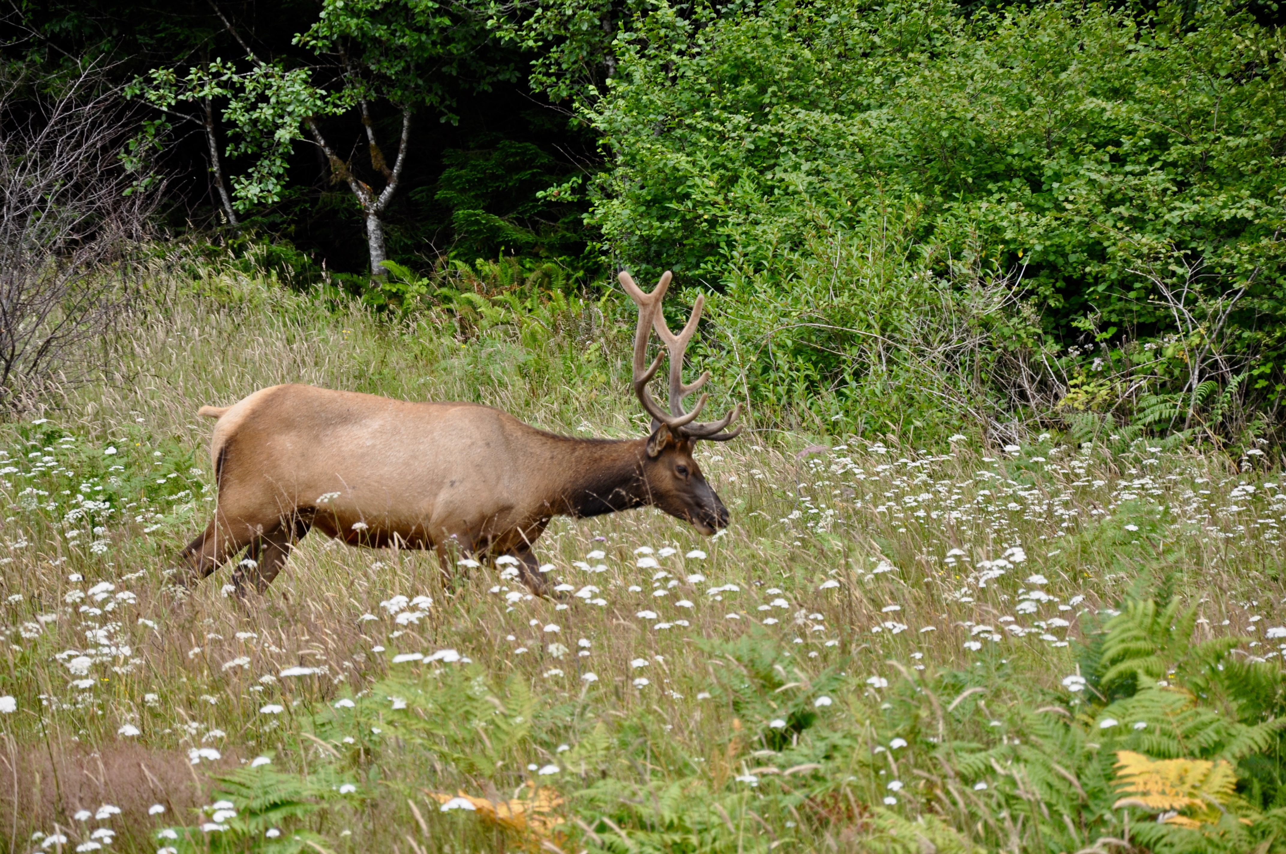
Don’t miss Elk Prairie Meadow outside the Prairie Creek Visitor Center. It’s a great spot for elk watching. We got some close-up views on our way out in the evening. Another highlight of the State Park here is Fern Canyon. Unfortunately, we didn’t have enough time to make it out there, but it’s definitely on the list for next time.
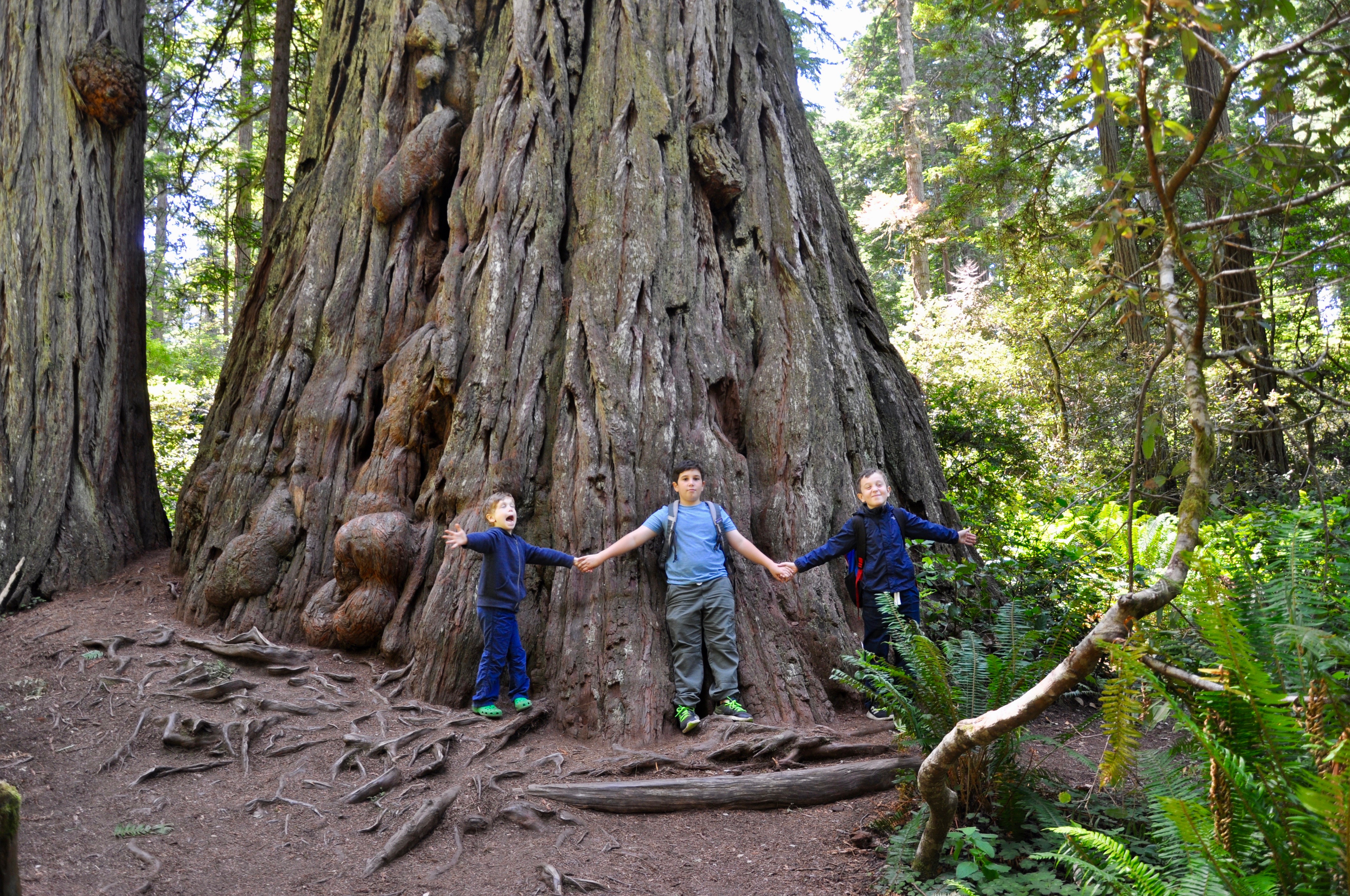
Big Tree Wayside
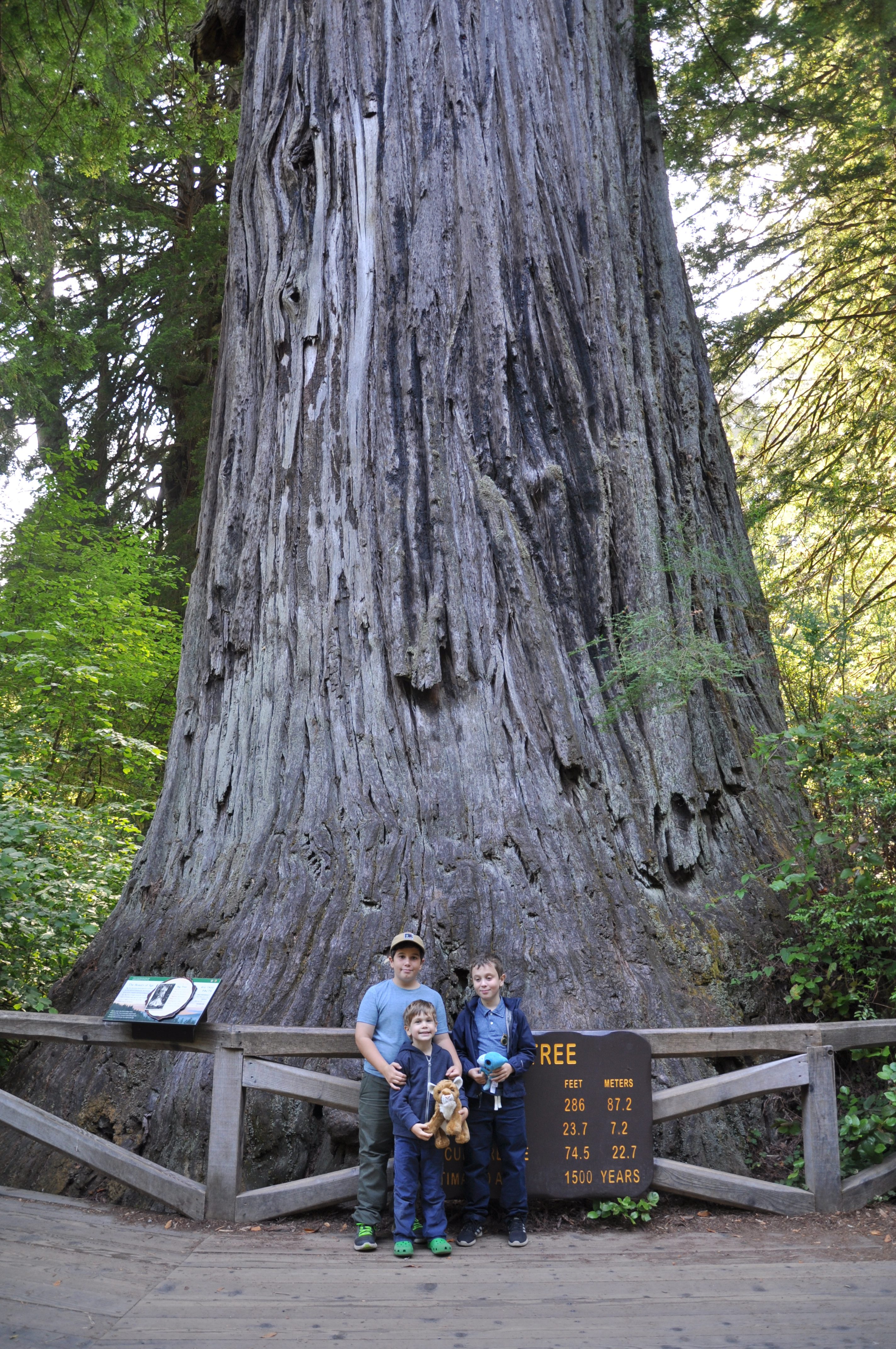
A quick, easy stop is the Big Tree Wayside walk. Only 200 yards from the parking lot, you’ll find the 1,500-year-old behemoth, which stands over 350 feet tall. Short walks from the Big Tree viewing area lead to even larger trees.
Beaches
The advantage of visiting the redwoods is you not only immerse yourself in ancient trees but also get lots of opportunities for rock hunting and ocean viewing.
Agate Beach
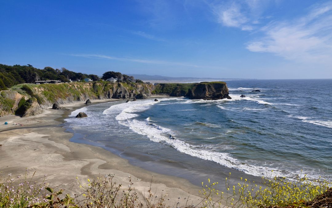
At Patrick’s Point State Park north of Trinidad, a steep cliff-side trail brings you down to Agate Beach. You could arguably spend a whole day here, lying on your stomach, sifting through the rocks in search of agates. We weren’t quite sure what we were looking for at first, but a nearby beachcomber took pity on us and showed us some examples of the translucent gem. While we searched, our youngest built a series of creeks and dams alongside a trapped tidepool. It was one of our favorite spots, and we practically had to drag the boys away.
Ferndale & Centerville Beach
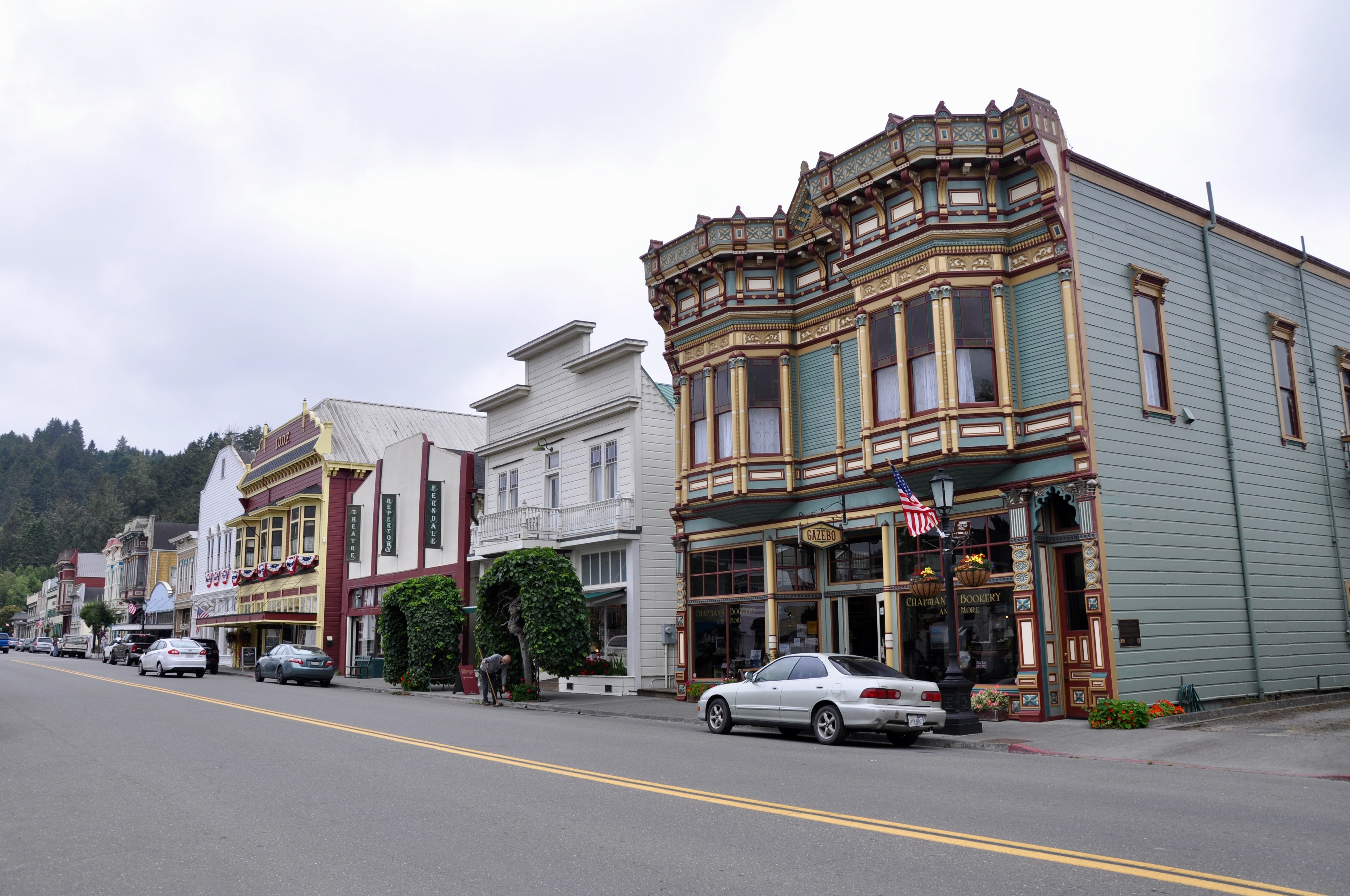
After seeing the advertisements for the Victorian village of Ferndale, we decided to give it a shot. A quaint town with an active Main Street, Ferndale was definitely a hidden gem. Every home and building in town seems to be both architecturally beautiful and historical, and in fact, the entire town is a California Historical Landmark. Our first stop in any small town is always the local bookstore, in this case, Chapman’s Bookery. We searched the guide books and kid’s books sections, excited to find The World of the Wazzlewoods by Tyrel Bramwell, a kid’s chapter book set in Ferndale.
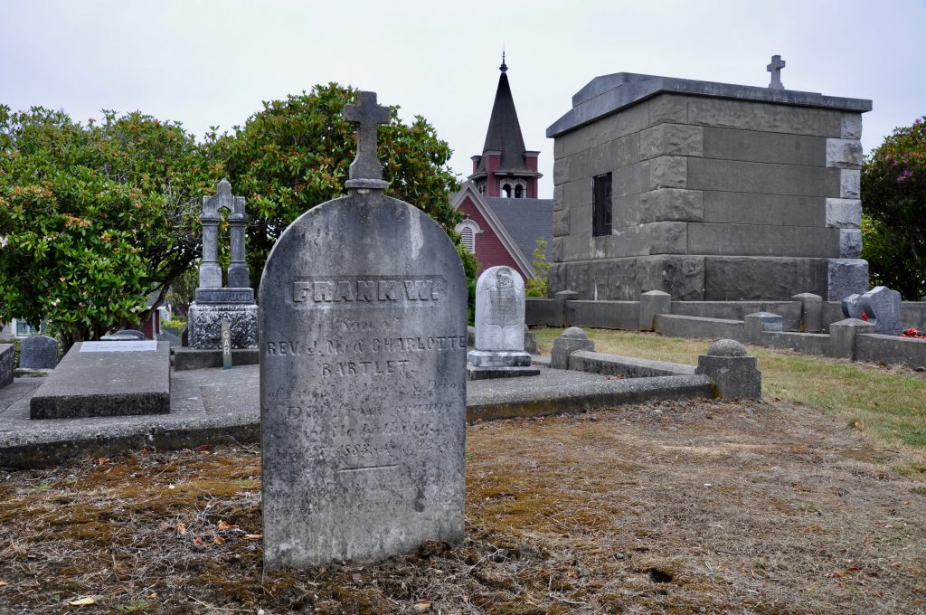
Besides knowing a lot about books, booksellers are generally a great resource for recommending the top sights to hit in the area. This one was no exception, pointing us toward the historic cemetery, which rests on a hill at the edge of town. Some of the graves here date back to the 1800s. Also be sure to check out Golden Gait Mercantile, where I could have spent my paycheck on kitchen gadgets, but ended up settling for some old-fashioned candy.
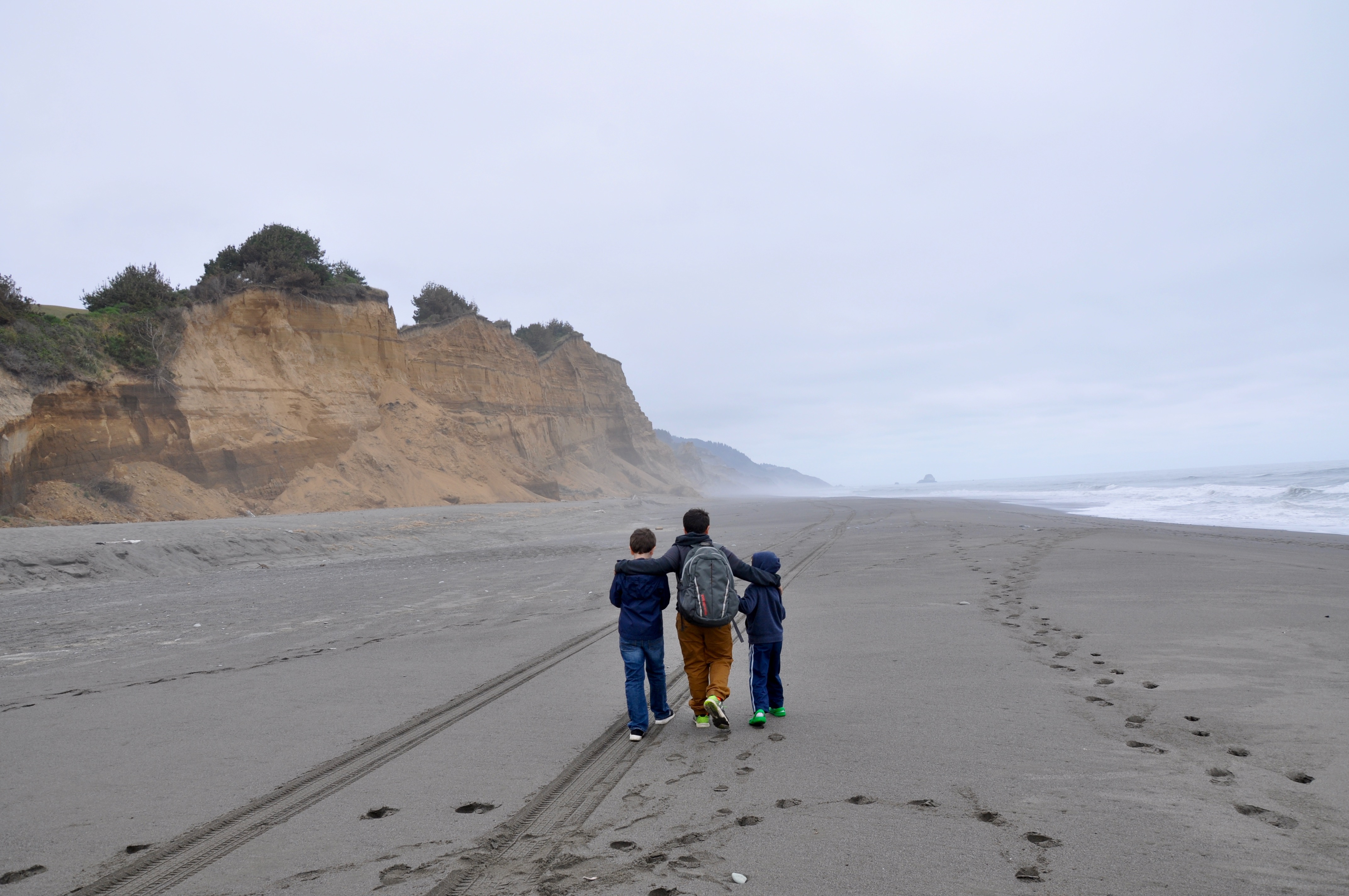
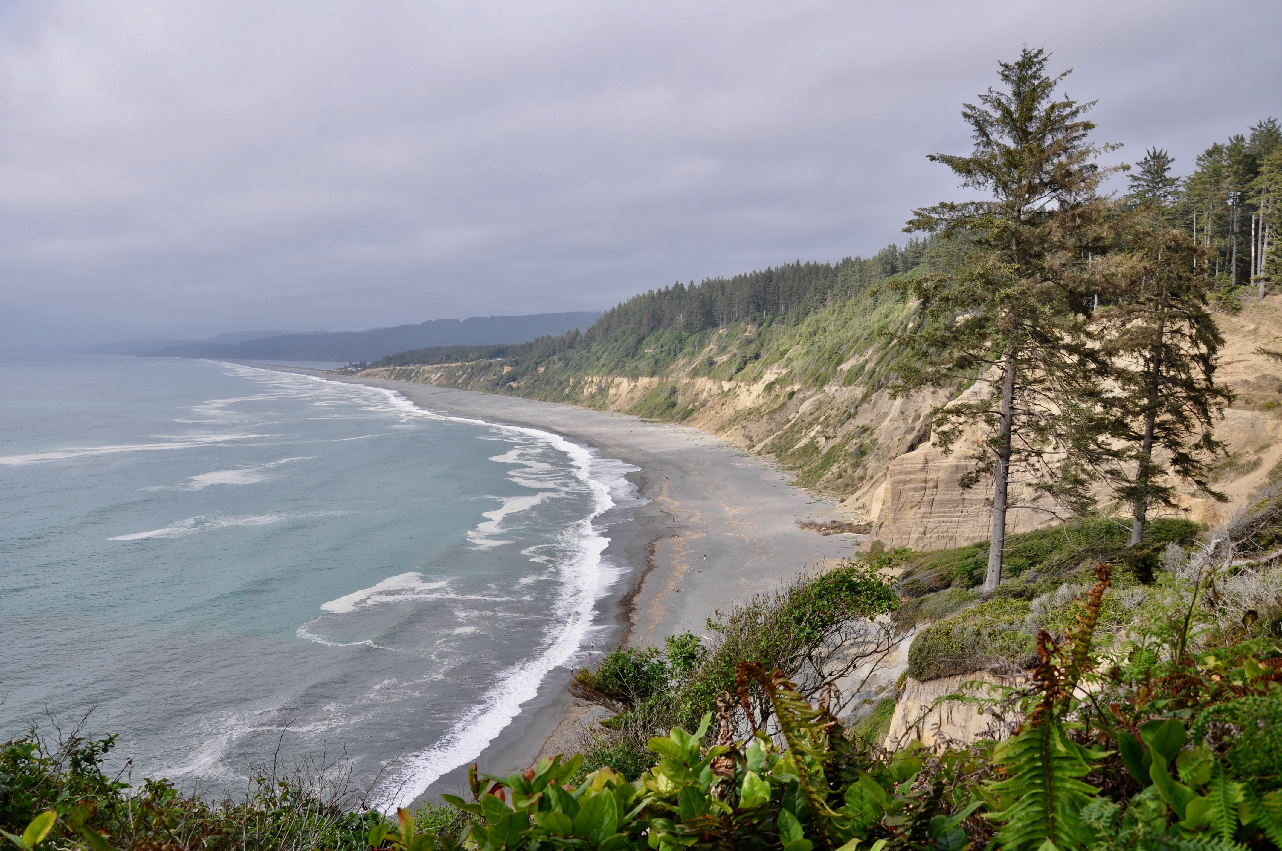
Centerville Beach was a 10-minute drive out of town, down a nearly deserted road through farmland. We questioned our directions until the road brought us right up to the sand’s edge. There were quite a few fireworks remains left over from July 4 celebrations, but after we walked down the beach a ways, the area looked more pristine. We practically had the sand and surf to ourselves, as very few people had ventured out today. We were drawn to the huge cliff south of where we had parked and spent much of the afternoon walking along its base and searching for colorful rocks.
Eureka and Moonstone Beach

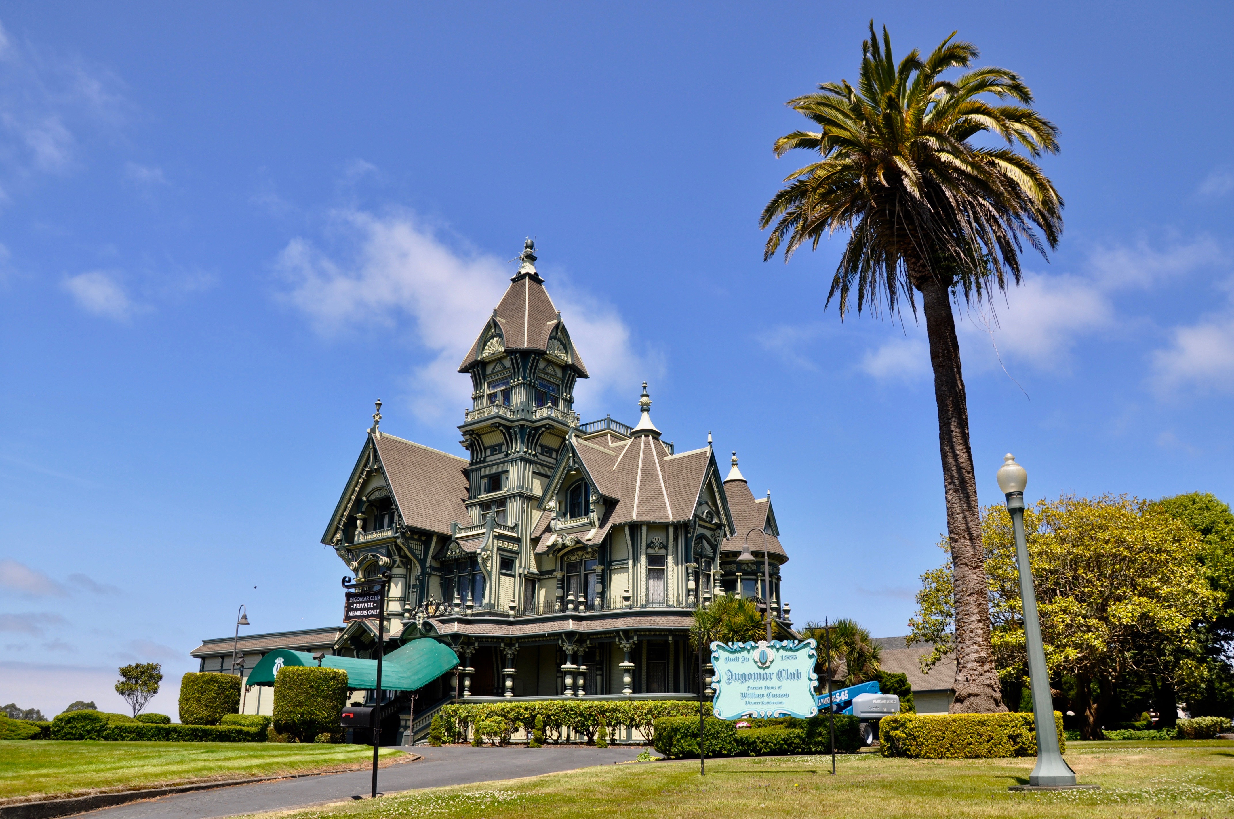
On our way back north, we took Waterfront Drive through Eureka, stopping to gaze at Table Bluff Lighthouse and the Fisherman Memorial on Woodley Island across the channel. At the end of 2nd Street, we ran into Carson Mansion, a stunning Victorian mansion built in 1885. Today it houses the private Ingomar Club.
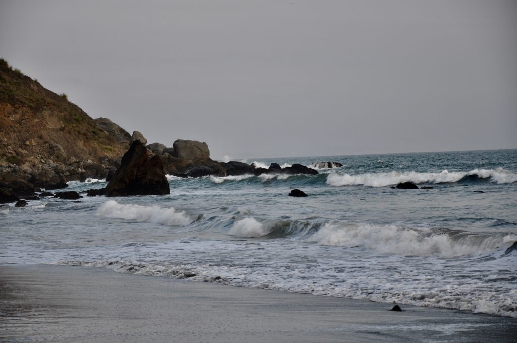
Continuing on, we took a chance at Moonstone Beach. Like all the others, it was beautiful, with Little River flowing through the center of it right out to the ocean. But don’t be fooled by the name. There are no moonstones here. However, on the north end, we discovered a small waterfall spilling from the cliff into the sand and small caves for exploring. It was the perfect spot for three boys to let their imaginations run wild.
Trinidad Beach
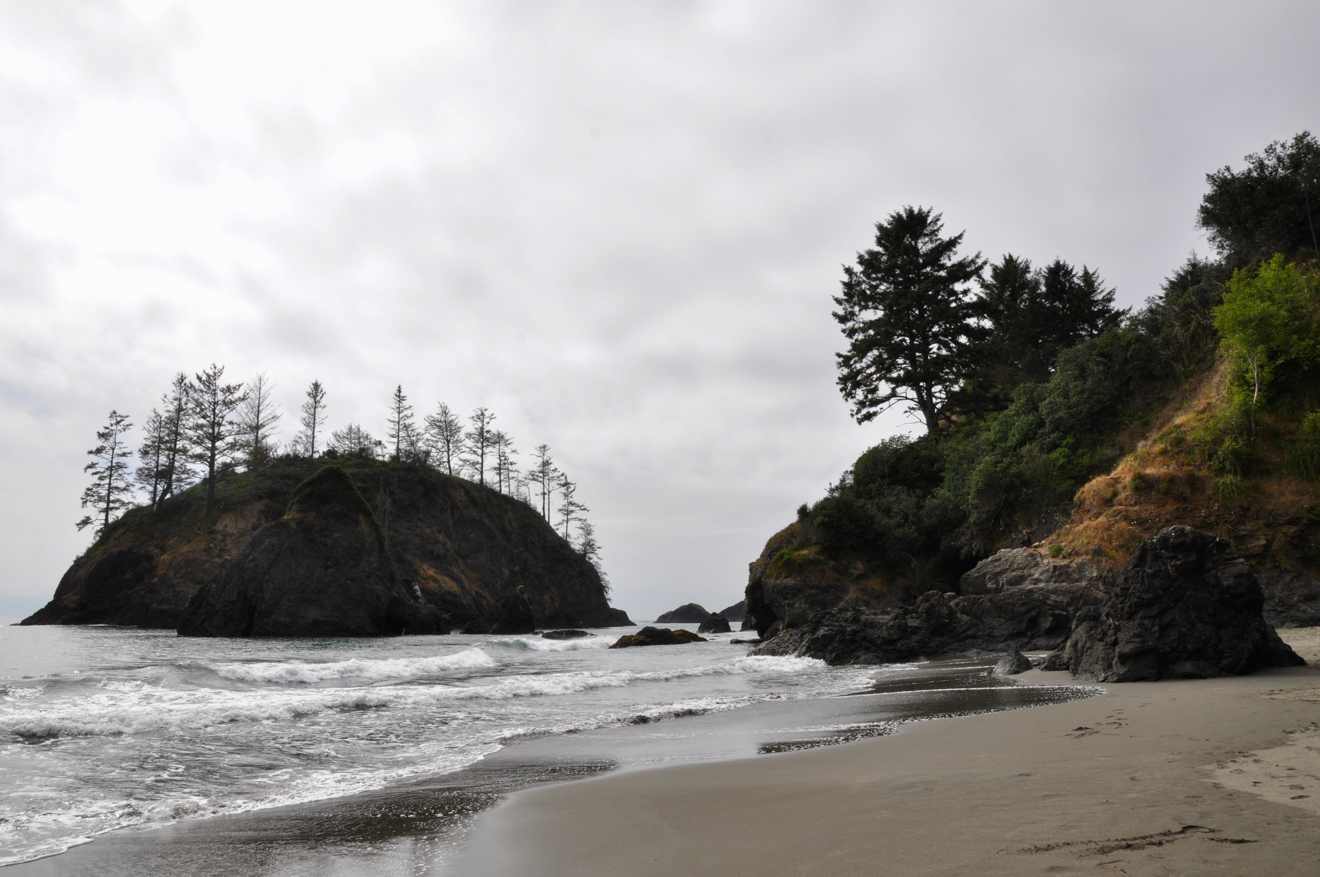
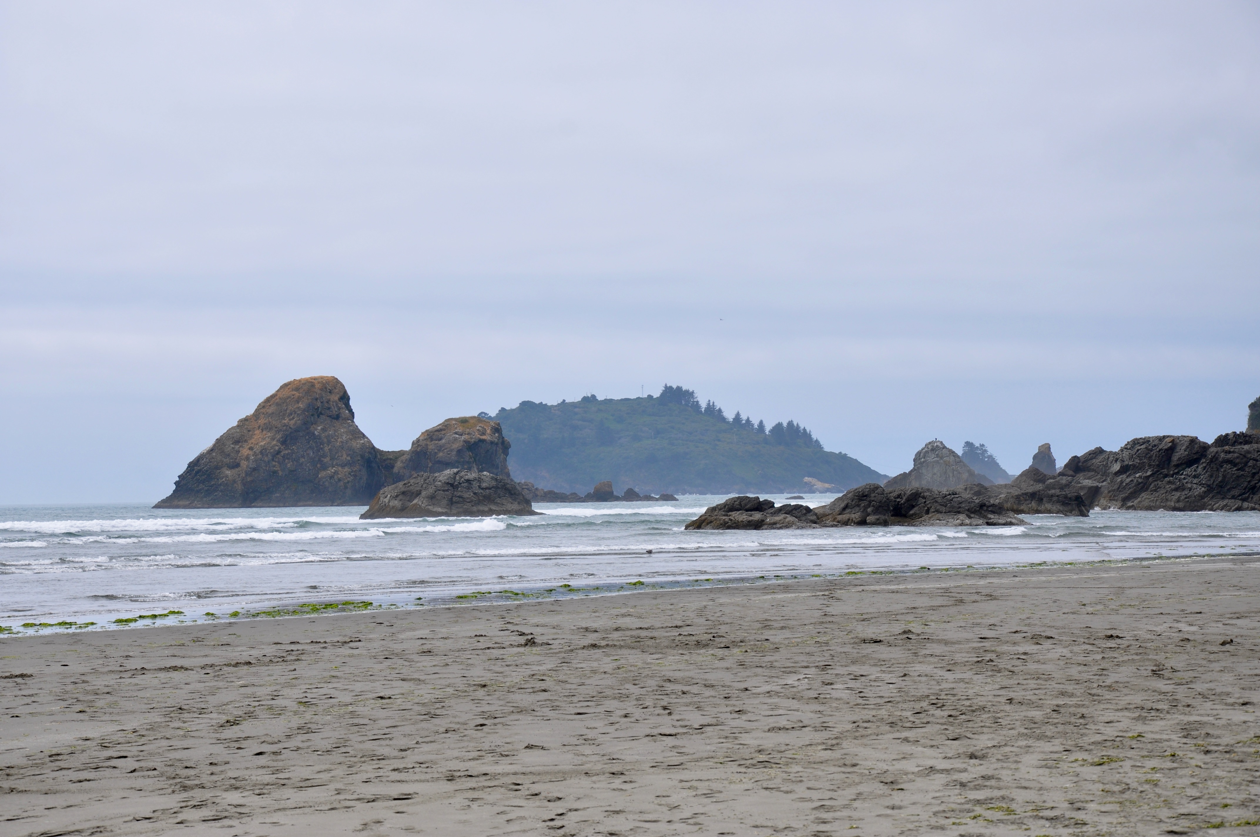
Our last pull off for the day was at Trinidad Beach, just off the parking lot at the end of Lighthouse Road. To the north, the view of the rock outcroppings here was worth the stop. But the kids loved their “secret tunnel” on the south side, where they built a fort out of driftwood and searched for fossils along the base of the rocks. It was their own private hideout tucked away out of sight from the rest of the beachgoers.
by Kristy Christiansen | Aug 16, 2019 | California, Featured Posts
Our most recent summer destination was northern California. After a terrifying flight and unexpected landing in Colorado, we finally made it to San Francisco. Glad to be on land again and anxious to begin our ten-day driving tour, we threw the bags and kids in the rental and took off. We had 10 days to drive a loop from San Francisco north to the Redwoods, east to Mt. Shasta and then back south through Lassen Volcano. It was a whirlwind tour, with probably enough content for a whole book! But I’ll give you the abbreviated highlights from our favorite parts of the trip. Here is our leg along the northern California coast:
Baker Beach
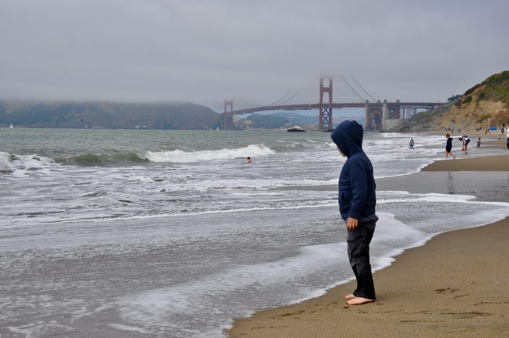
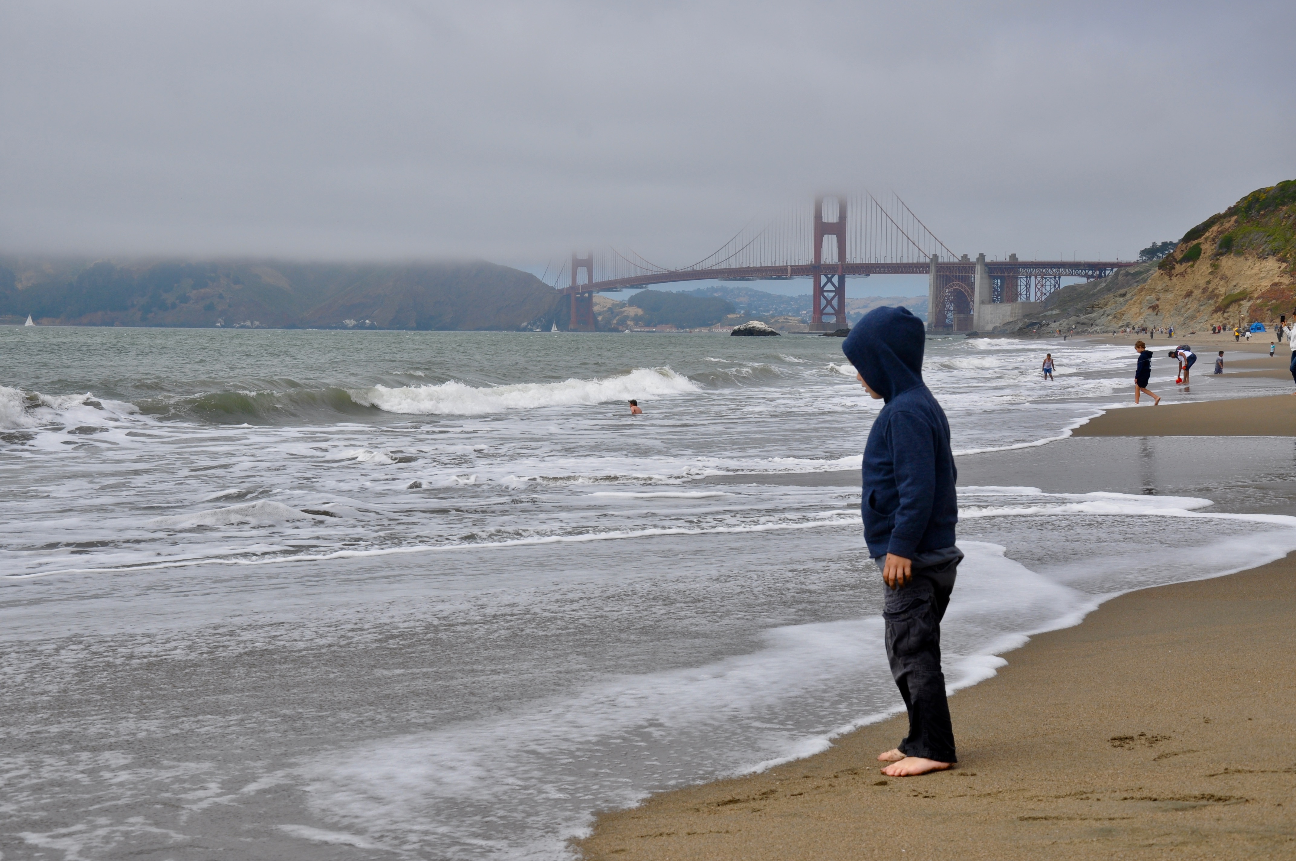
As this was our third trip to San Francisco, we only allotted two days in and around the city – our first and last days. This was just enough time to hit our favorite spots, starting with Baker Beach. On a Friday after lunch, the parking lot and beach were packed to capacity. Kids in bathing suits were playing in the sand and dipping their toes in the frigid water. Being from the South and used to much warmer weather, we shivered in our jeans and jackets. But we didn’t come here to go swimming. Besides the cold, the waves are pretty rough. We came here for the photo op. It’s one of the best places to capture a shot of the Golden Gate Bridge. Besides, it gave our five-year-old some much needed time to run around and dig in the sand.
The Pelican Inn
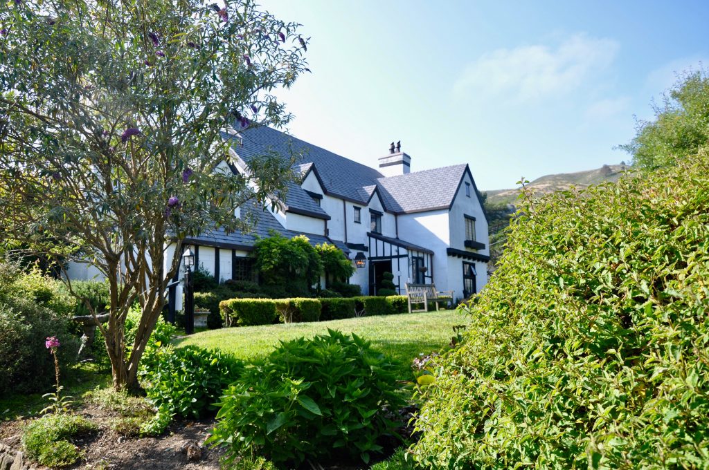
We had a little time before our 6 p.m. parking appointment at Muir Woods. (Yes, in case you haven’t heard, you now need to schedule a time to visit Muir Woods and either reserve a parking spot or a shuttle.) So with time to kill and dinner on our minds, we swung by The Pelican Inn for fish & chips and an English dip sandwich. In between bites, the kids chased birds around the garden, and we watched horses trotting down the road, probably taking their riders to nearby Muir Beach.
Muir Woods National Monument

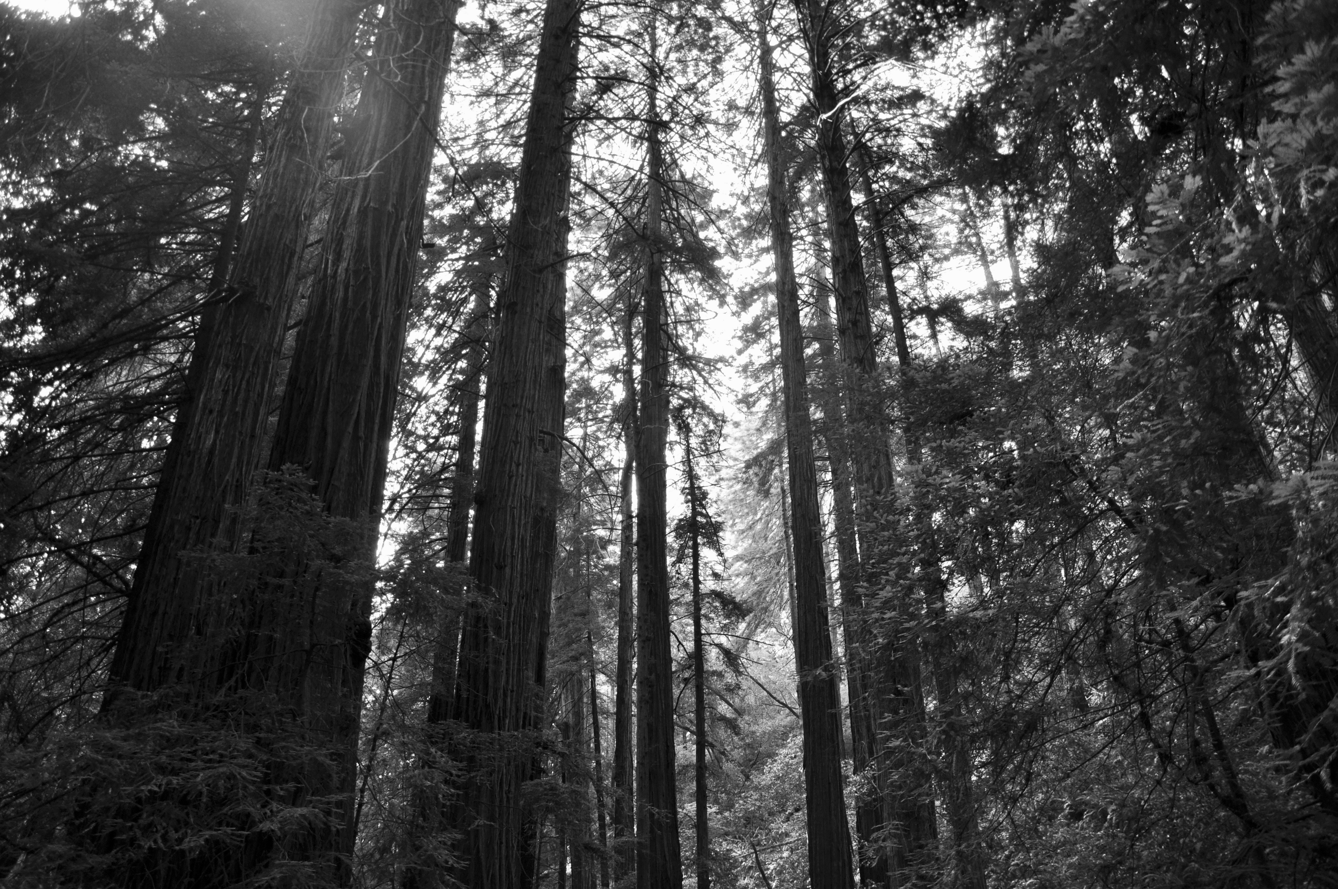
Next up was Muir Woods National Monument. It’s a great, brief introduction to the redwoods before viewing the giants up north. I originally was bummed to get such a late time slot at Muir Woods, but it turned out to be a blessing in disguise. The national monument is open until 8 p.m. during the summer and normally packed. When we arrived, we got a parking spot right up front and practically had the place to ourselves. It’s hard to really experience nature when you’re surrounded by people, so this was perfect. I had printed Junior Ranger booklets back in New Orleans, so armed with their packets and pencils, we stepped into the woods.
As close as Muir Woods is to bustling San Francisco, it feels like you’re worlds apart. The main trail is straight in and out, about an hour and half if you go to the end and back. It’s nicely paved, each side of the trail flanking a stream running down the middle. With the redwoods towering above us, we felt very small next to the tallest living things in the world. As the light dimmed, we finished our hike, and Park Rangers swore the kids in as the newest Junior Rangers.
Muir Beach
On our way out, we stopped by Muir Beach. It was a short trail down to the water, where groups of kids were huddled around bonfires. Hoards of pelicans flew overhead. My oldest counted over 500 before we finally dragged them away. We still needed to make it to Petaluma for the night.
Luther Burbank Home & Gardens
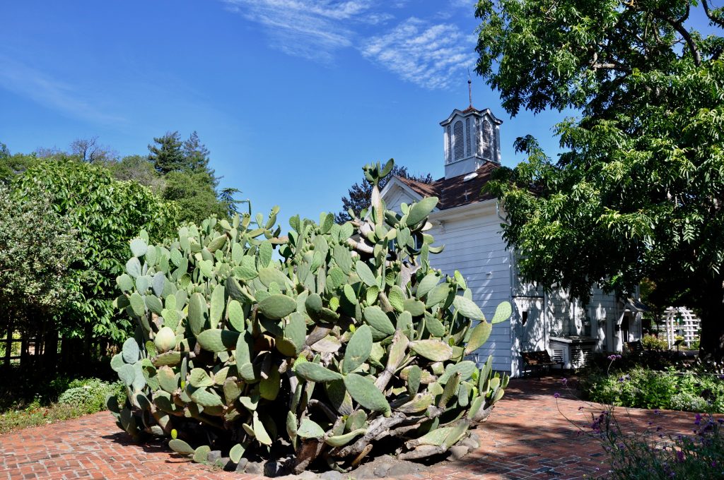
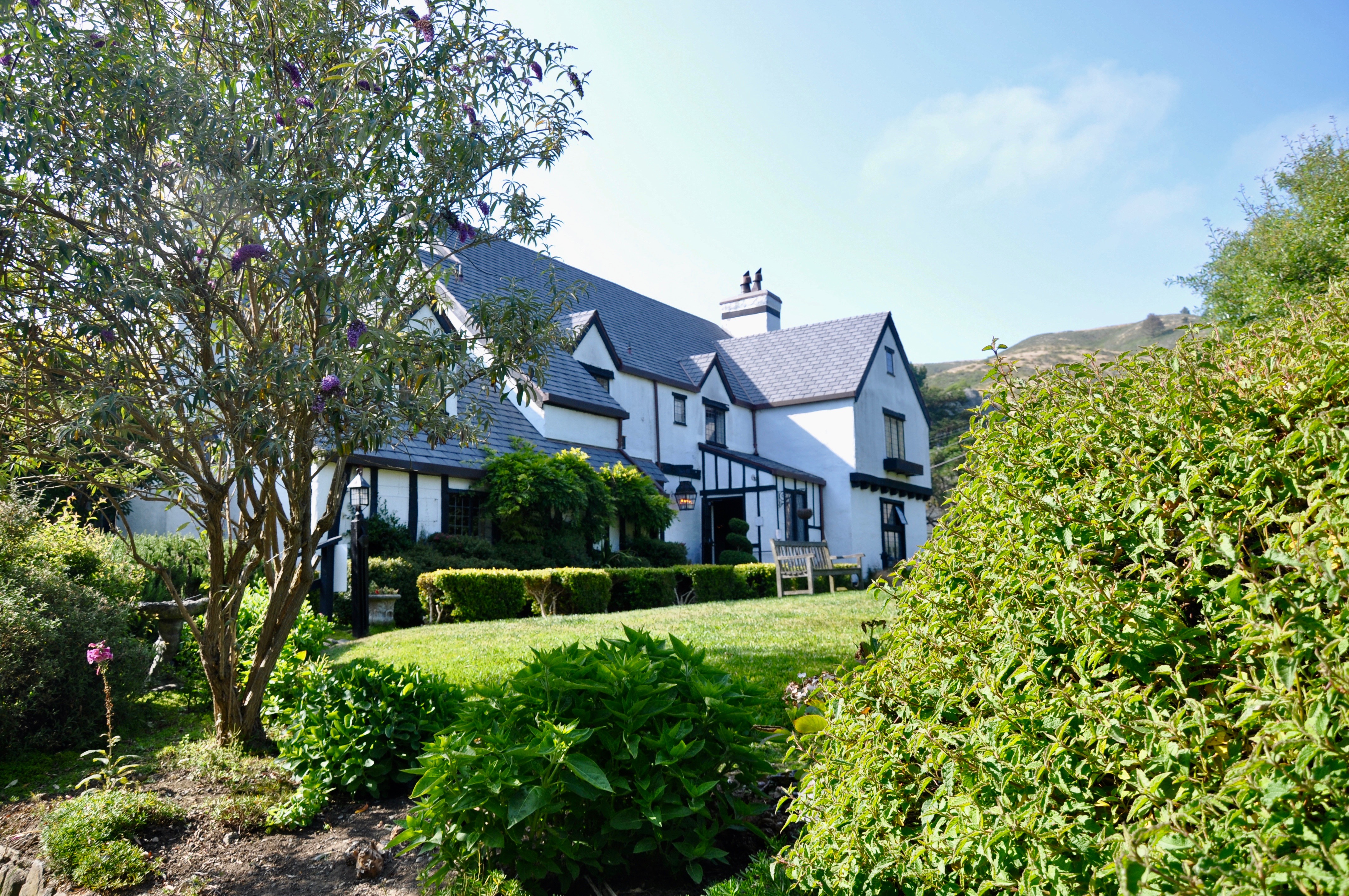
The Pelican Inn was our one splurge on eating out, but now we had to get serious about food. Finding a Trader Joe’s in Santa Rosa, we picked up breakfast and plenty of road trip snacks and had a little picnic at Luther Burbank Home and Gardens. It was early morning, and our only company was the groundskeeper, who welcomed us to enjoy the gardens. Luther Burbank had a 50-year career as a horticulturist, developing many new plants throughout his life. My husband, Paul, is an avid gardener himself. Our little patch of land in New Orleans is exploding with colors and hundreds of plants. And his pride and joy is his spineless cactus, created by none other than Luther Burbank. (It’s also a favorite snack for our red-footed tortoise!)
We couldn’t stay long, though, as we needed to make it all the way past Eureka before nightfall – with several stops planned along the way… Here are some of our favorites:
Hwy. 1 Beaches & Ocean Views
Navarro Point
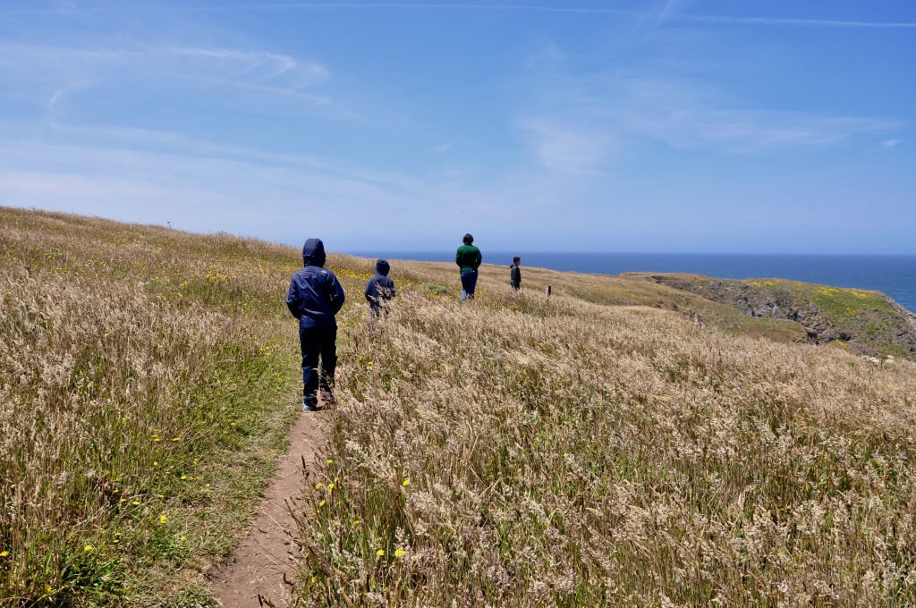
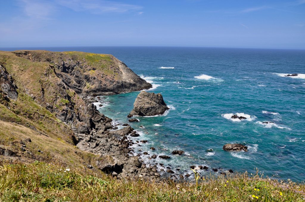
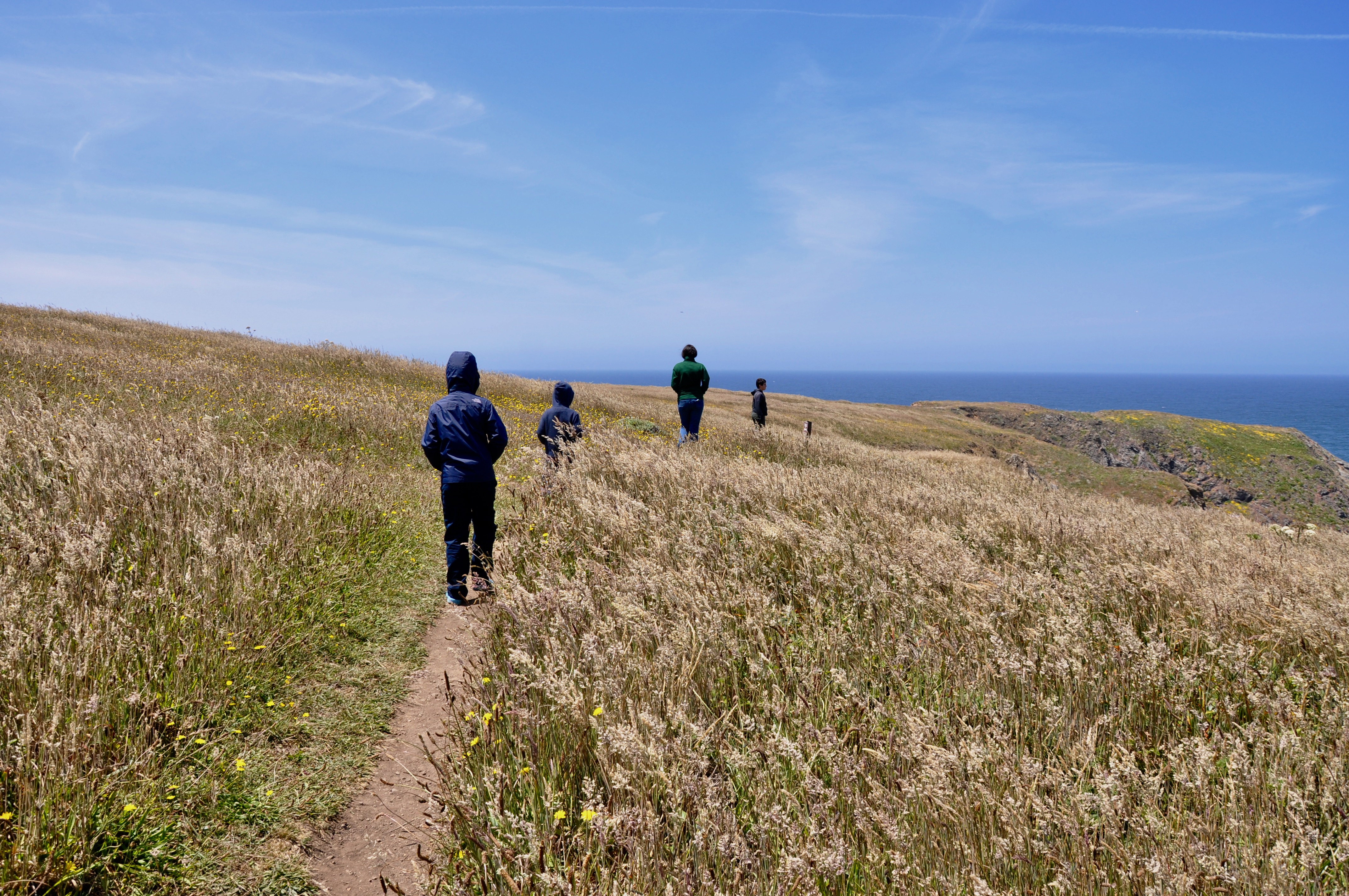
Driving west from Cloverdale along Hwy. 128, the road winds past small vineyards tucked away in hidden hills. You then pass through Navarro River Redwoods State Park, where for 11 miles, second growth redwoods crowd right next to the highway. And then it opens up to Hwy. 1, and the Pacific Ocean glistens before you. We parked at Navarro Point Preserve and hiked the trail through the wildflowers. The reward was expansive ocean views high atop a cliff, with sea lions playing on the rocks below us.
MacKerricher State Park

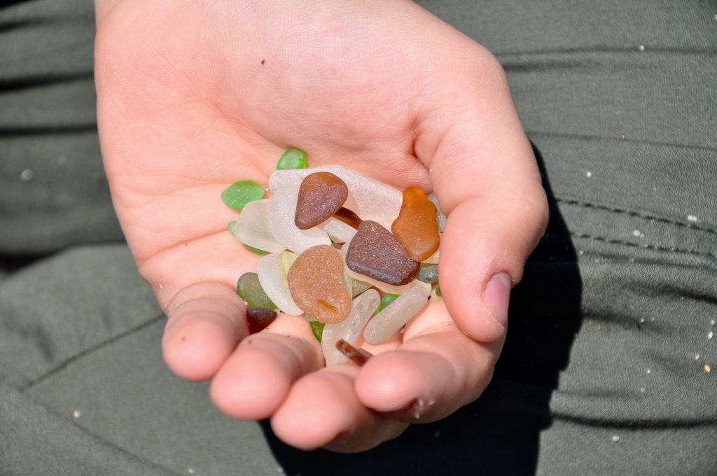
In Fort Bragg, MacKerricher State Park manages nine miles of the coastline. Highly popular Glass Beach was once a dump site following the 1906 great earthquake. Apparently the townspeople hoped that the trash would wash away, but instead the stubborn ocean kept washing it back on the beach. A hundred years later, all that remains are the handfuls of colorful sea glass littering the beach. Take all the pictures you like, but as this is a state park, you’re not allowed to leave with any glass.
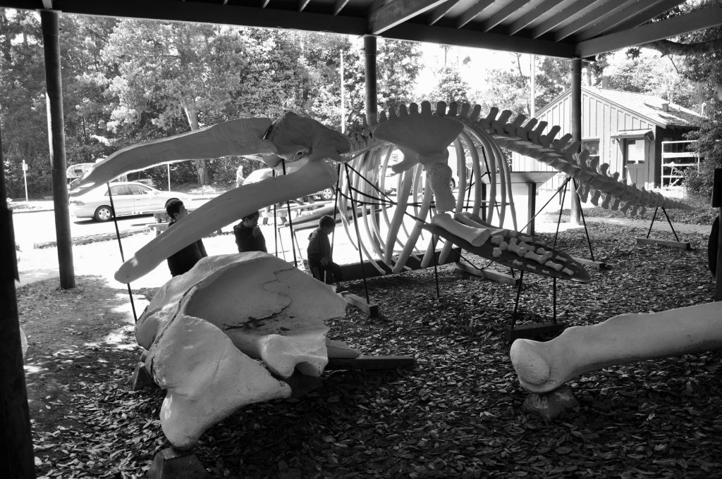
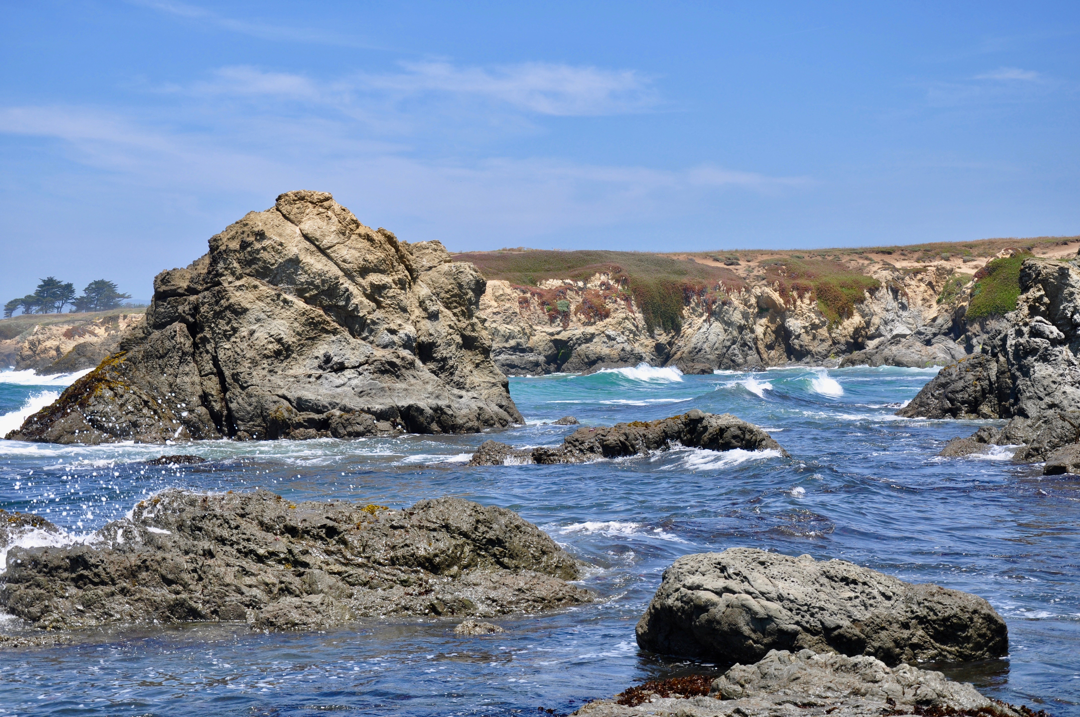
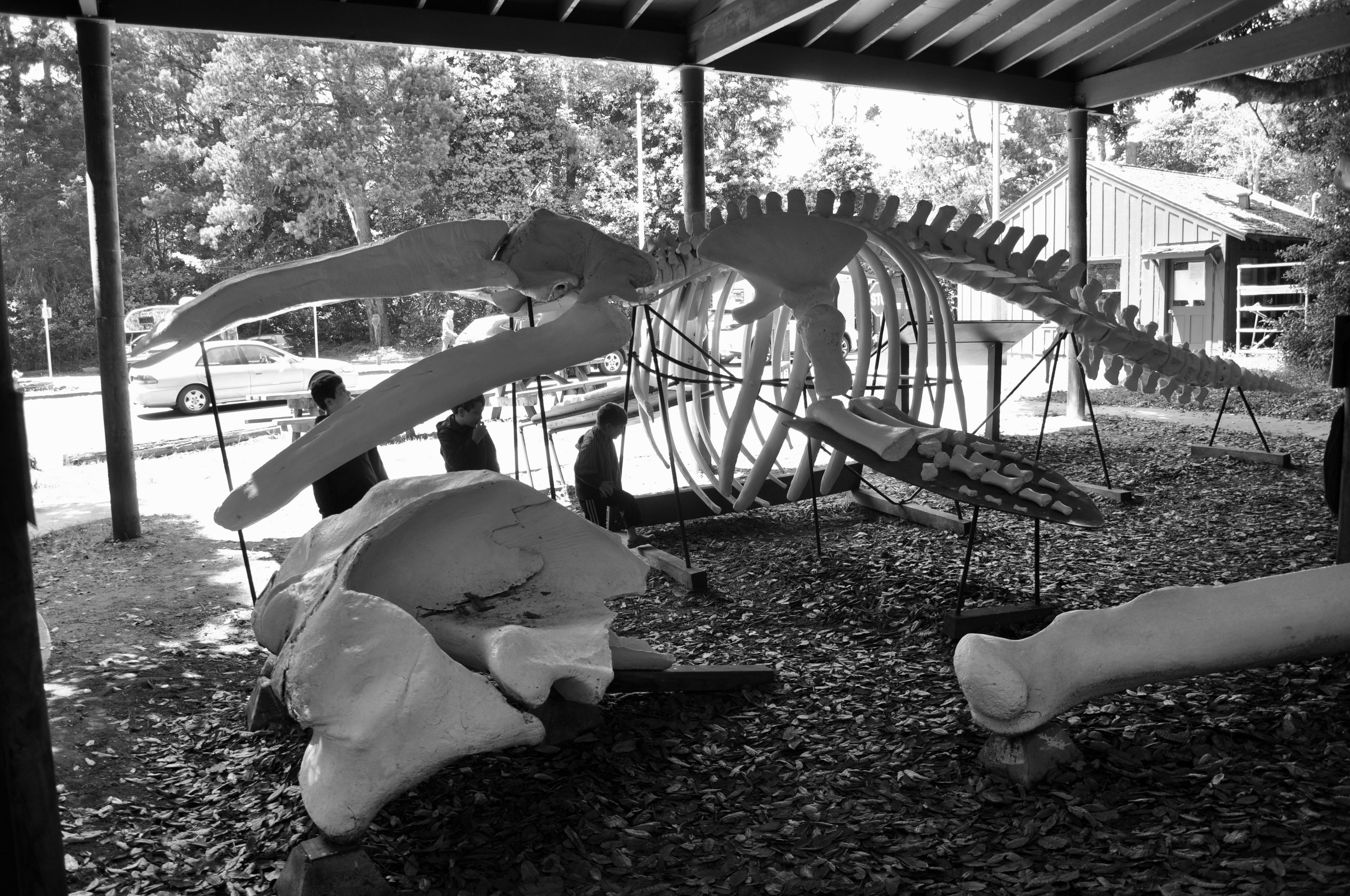
At the main entrance to MacKerricher, visitors are greeted by an impressive whale skeleton. The road brings you around to the beach and a trail to Laguna Point. The seal watching station here offered one of the best views of both harbor seals and sea lions lounging on the rocks before us.
Hwy. 1 north from Fort Bragg offered breathtaking views of the Pacific Ocean around every turn. The road then turned inland back to Hwy. 101. Much of this stretch – 31 miles – is mirrored by the Avenue of the Giants. We had driven this route years before, but unfortunately there wasn’t enough time to take it again. Our Airbnb in McKinleyville awaited. It was indeed a “Charming Farm Barn Loft,” and anyone traveling in the area should check it out.
by admin | Aug 15, 2019 | Featured Posts, North Louisiana
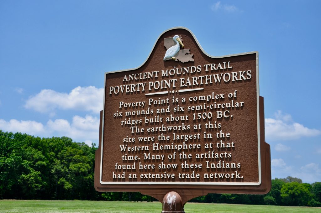
Since our days at LSU, we have always been fascinated by mounds. It may have been climbing the mounds on LSU’s campus that got us started, and we haven’t stopped! Poverty Point is the king of mounds, so important that this State Historic Site is also a National Monument and a UNESCO World Heritage Site. Located in the northeast corner of the state, the site is unique for the size and shape of its earthworks, but it’s not alone. Many mounds dot the landscape throughout this area. You can follow their trail on the Indian Mounds of Northeast Louisiana driving tour.
Poverty Point Culture
We began our tour at the visitor center, where we picked up Junior Ranger booklets for the kids. It’s a great way to encourage them to look around. While answering questions, they learned about the importance of the people who lived here and built these earthworks. The Poverty Point site is dated between 1700 and 1100 B.C. The inhabitants were pre-agricultural, relying on fishing, hunting and gathering for food. They had a complex trading system, using soapstone from Georgia and Alabama to make bowls and stone from the Ouachita and Ozark mountains for tools.
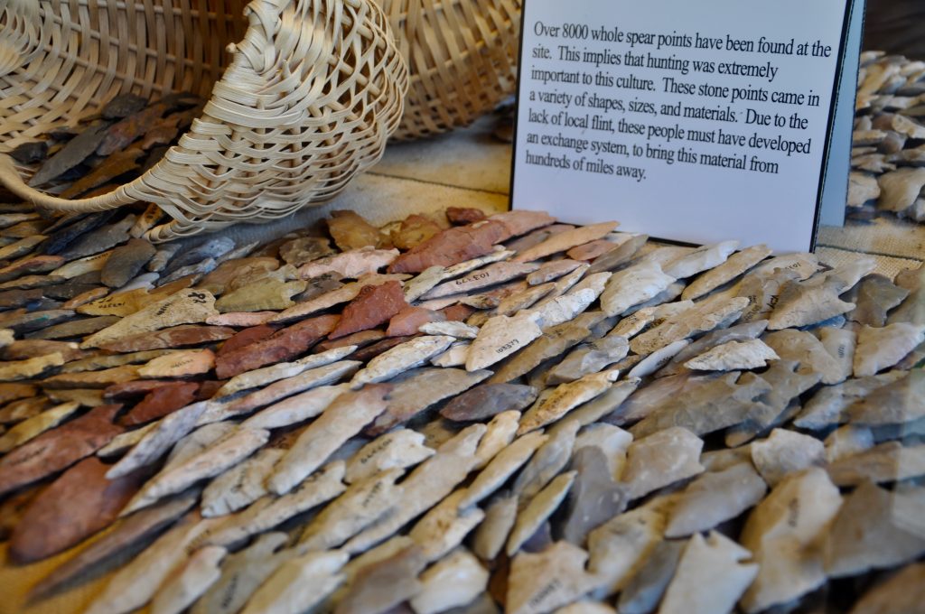
An impressive display of spear points is just a small amount of the more than 8,000 found at Poverty Point. But the most commonly found items are small clay balls. Known as Poverty Point Objects (PPOs), they were heated and then used for cooking food.
Earthworks and Mounds
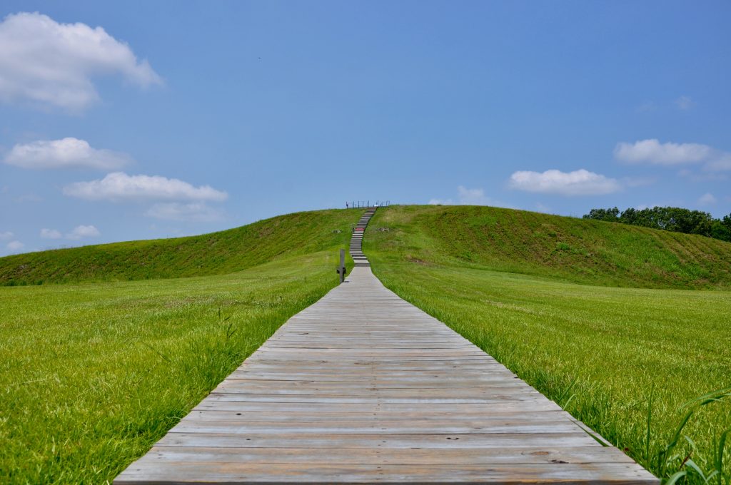
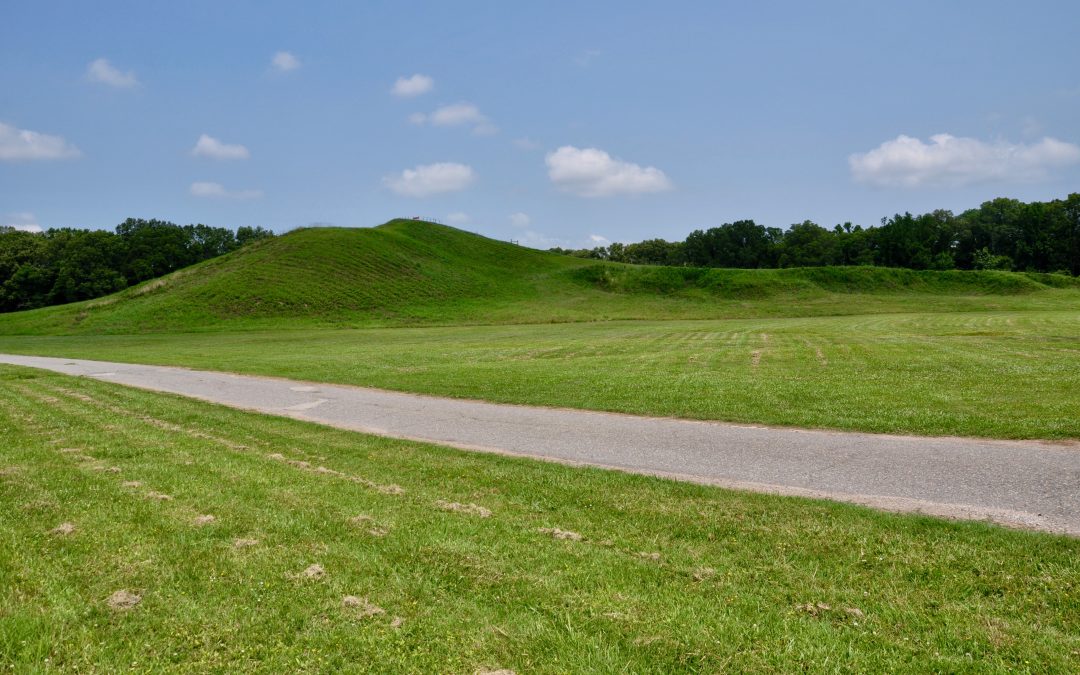
Back outside, we consulted our map and drove across Highway 577 to begin our tour. The loop trail passes right through the main earthworks–six rows of half-circles, which measure 3/4 of a mile in diameter and are each 4 to 6 feet tall. Archaeologists have found postmolds on top of these ridges, stains in the soil that are evidence of the remains of houses. Beyond the earthworks is one of the largest mounds in North America–Mound A. Sometimes called the bird mound, it’s 72 feet tall and 710 feet long and 660 feet wide. It may have taken 15.5 million basket loads of earth to build. It was quite a hike on a hot day just to go up and down those steps. I can’t imagine carrying dirt back and forth to build it!
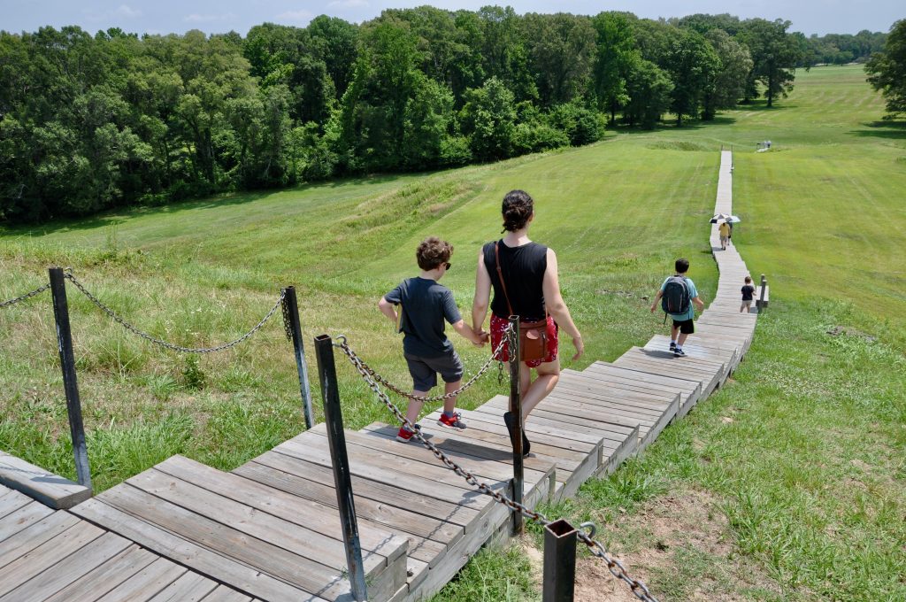
What makes Poverty Point so unique is the site’s enormous size as a major cultural center. This was the late Archaic period, when most everyone was living in small groups. But here, at Poverty Point, it’s estimated that hundreds of people lived together. In addition to Mound A and the earthworks, there are four smaller mounds on the property as well. The short driving tour brings you past them and back to the Visitor’s Center.
Hands-On Learning

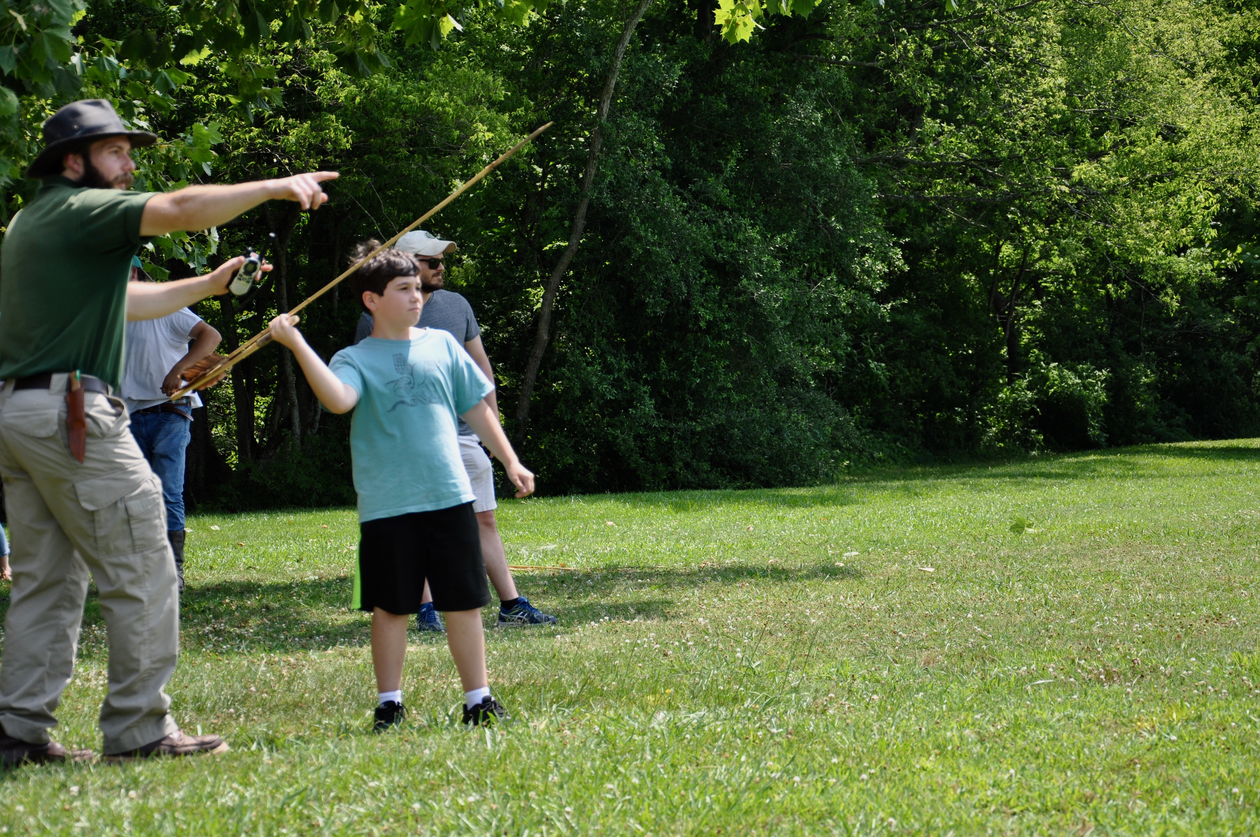
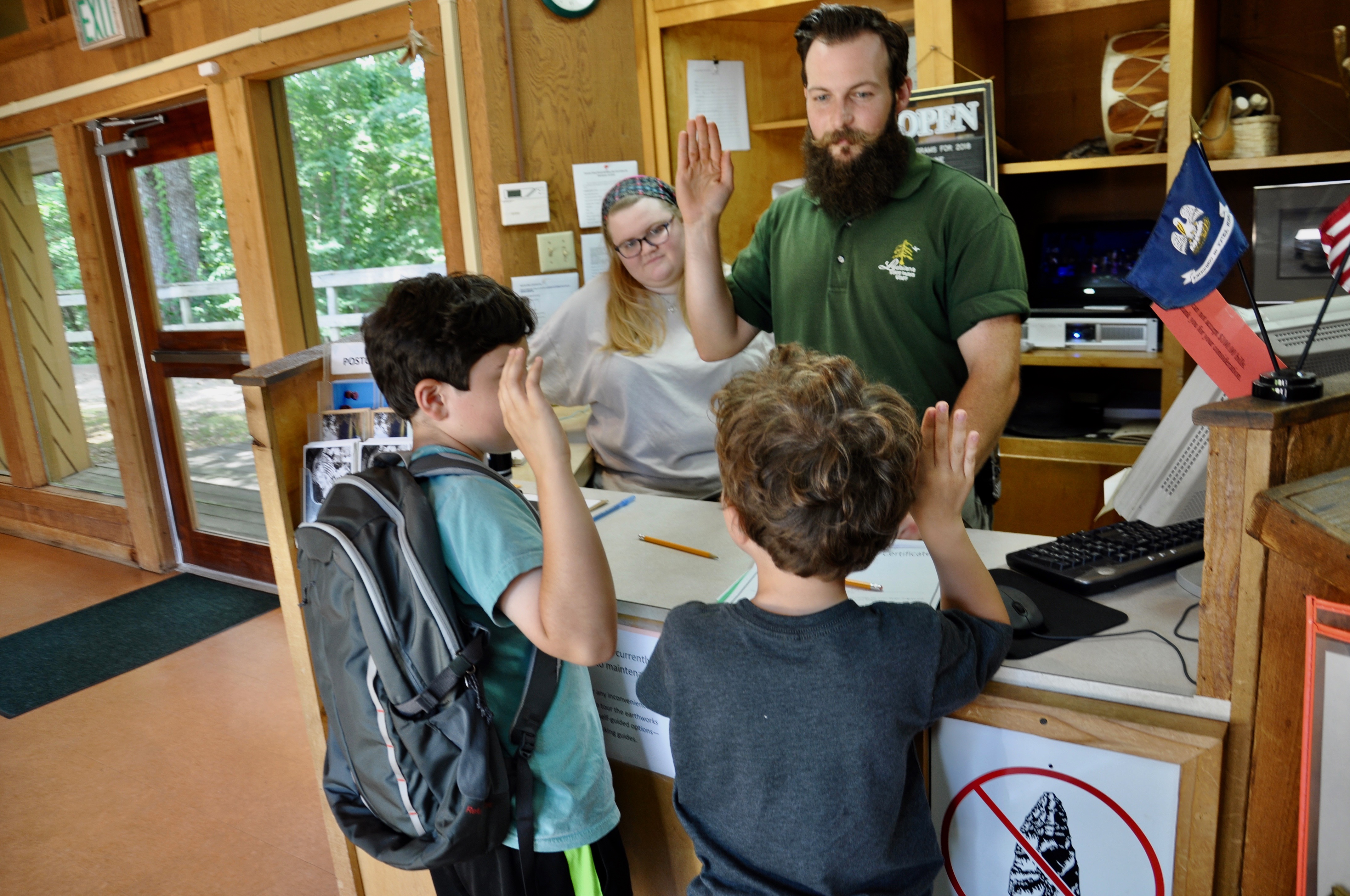
We were lucky to catch an atlatl demonstration when we returned. It’s basically a stick with a hook on the end to attach a spear. Once you get the hang of it, it launches a spear much farther than you can throw one. The boys took turns practicing and our oldest actually won the contest for his age group, bringing home his very own spear point. Marking off the last of their Junior Ranger books, the two older boys were sworn in as Junior Rangers, adding another badge to their growing collection.

by admin | Jun 18, 2013 | Featured Posts, Greater New Orleans
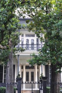 |
| Another Garden District Beauty |
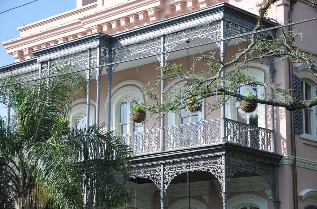
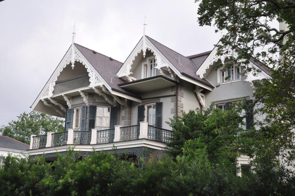
In the midst of t-ball and swim lessons, we’ve been sticking close to home as of late, taking short adventures in and around New Orleans. Our latest outing was something we rarely do, a guided walking tour of one of the most extravagant sections of the city – the Garden District. Once home to wealthy Americans looking to settle outside of the French Quarter, today many of the area’s mansions boast historic signs detailing fascinating stories that often end with links to Hollywood stars.
We met our guide, Kevin from NOLA Native Tours, on Magazine Street at the Defend New Orleans store. The early morning weather was clear with a cool breeze that made the shaded sidewalks comfortable on this mid-summer day. Kevin led us north on 1st Street, deep into the heart of the quiet neighborhood. Aside from the occasional dog-walker, we had the street to ourselves, with no one watching us gawk at the beautiful homes before us.
In the early 1800s, this area was known as the city of Lafayette, eventually annexed by the city of New Orleans in 1852. Our tour guide pointed out notable architecture styles, from Victorian to Italianate and Greek Revival, all with varying degrees of cast iron railings and flickering Bevelo gas lanterns. I was particularly fascinated by the large marble slab lying by the curb in front of one of the homes. I never would have guessed it was once used as a step for ladies exiting carriages, a fact that so easily painted an imaginary scene of well-dressed revelers arriving in their carriage for an evening party.
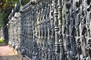 |
| Cornstalk Fence |
We passed the home where Jefferson Davis, the first and only president of the Confederacy, died. Nearby, vampire-author Anne Rice grew up in the Brevard-Rice house, just a few steps away from the Mannings’ mansion (yes, that would be the Mannings…football icons Archie, Peyton and Eli). On Prytania, the French flag waved in front of the French Consulate, while across the street, a rectory once built for Redemptorist priests later became another possession of Anne Rice and then actor Nicholas Cage. Meanwhile, an intricate cornstalk fence surrounded one grand home, proving that the famous fence does exist outside of the French Quarter.
The tour paused at the Rink, a collection of boutique stores, the Garden District Book Shop and a coffee shop, before unleashing us inside Lafayette Cemetery Number 1. We spent nearly half an hour here, photographing the elaborate above-ground tombs with springy plants emerging from their crevices. This city of dead is crowded and slightly crumbling, details that somehow make it even more alluring.
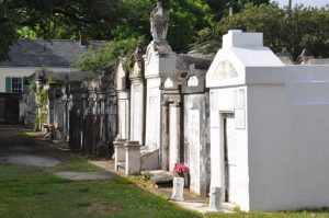 |
| Lafayette Cemetery |
The last stretch of our journey showcased one of the city’s best-known restaurants – Commander’s Palace, and exquisite homes perhaps more famous for their architecture than for their Hollywood owners (Sandra Bullock and John Goodman). It was a pleasant walk in the hands of a knowledgeable tour guide, one who casually turned a morning stroll into an exploration of beauty, time and entertainment.
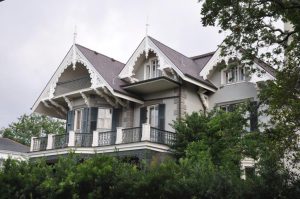 |
| Sandra Bullock’s Garden District Home |
by admin | Jan 15, 2013 | Featured Posts, North Louisiana
From downtown Natchitoches, we took the winding Highway 494 out the east side of town into the rural countryside. Approximately 116,000 acres surrounding Natchitoches make up the Cane River National Heritage Area, which includes several state historic sites, national historic landmarks and the Cane River Creole National Historical Park. The latter is where we were headed, in search of learning more about the Creoles who once thrived in this area.
We had an ambitious day planned, stopping by both plantations included in the National Historical Park, Melrose Plantation in between and then Kisatchie National Forest on the back end of the trip. The route led us first to Oakland Plantation, where we rushed from the parking lot to the nearby pavilion, trying our best to escape the frigid morning air. We picked up a self-guided walking tour and followed the well-defined path toward the tractor shed and mule barn. Not only is the National Park property free to visit, but the scattered out buildings are all open wide for easy touring. We poked our heads inside one building after another, admiring the construction and discussing the old tools and remnants of the past.
 |
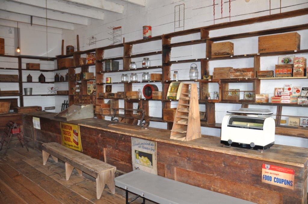
| Oakland Plantation Store |
The path steered us toward the old store and post office, which today serves as the Visitor’s Center. Inside, the drafty store held many of the same items available for purchase from when the site was a working plantation. As we poked around, a ranger appeared offering a tour of the main house. Luckily, we were the only ones present at the time, so she adjusted the tour to accommodate the attention spans of a four and two year old. After swearing the kids in as honorary rangers, she showed us the rare and highly guarded bottle garden, where old glass bottles lined the plant beds. We then entered the house, viewing an interesting mix of antique furnishings and modern conveniences such as a TV and “new” kitchen. The ranger told us about the owners, African Americans and Cane River Creoles who once lived and worked here before their property became a testament to the past.
.JPG) |
| Oakland’s Bottle Garden |
 |
| Honorary Ranger Charles |
From Oakland, the road followed the river to Melrose Plantation, significant for the artist colony it once held and the cook turned self-taught artist known as Clementine Hunter. We paid to tour the grounds, and started on the far side of the main house by an abandoned cellar. The kids were overjoyed to find the remains of an armadillo inside, and four-year-old Charles busied himself snapping hundreds of photos with my husband’s iphone. Caught up in his excitement, he dropped the phone inside the doorless building, and Paul was forced to jump through an open window into the pit below to retrieve his phone.
.JPG) |
| Melrose Plantation |
.JPG) |
| Africa House at Melrose Plantation |
Adventure now over, we were able to hustle the kids around to the property’s other historic buildings, such as the Yucca House built between 1796 and 1814 and the highly unusual Africa House and its upstairs Clementine Hunter murals. Hunter’s own small cottage was nearby, another favorite of the children for the lizard that had taken refuge from the cold on her porch.
By now needing lunch, we didn’t stay long at Melrose but were glad we stopped to view this important piece of Louisiana history. The Cane River trail stays true to its past, depicting rural life in the Natchitoches area. Unfortunately for us, this also meant no restaurants in sight. So we scrounged around for the last of our snacks and carried on to Magnolia Plantation, the second of the two National Park properties.
.JPG) |
| Slave Cabin at Magnolia Plantation |
The main house at Magnolia is still privately owned, but the store, a collection of slave houses and a gin barn are all open to the public. Stopping to briefly chat with the ranger inside the Visitor’s Center, he encouraged us to walk the lands and take a look inside the gin at the only wooden screw-type cotton press remaining in its original site. A stack of paper bags lay next to a sign encouraging visitors to gather pecans, so we gave each of the kids their assignment and let them loose. While they competed to see who could find more pecans, we walked around the eight brick slave cabins and viewed the exhibit inside the farthest one. A modified Catholic miraculous medal and several bottles were displayed, evidence of hoodoo rituals and a reminder to me of the Travel Channel’s “Ghost Adventures” show shot here.
.JPG) |
| Kisatchie National Forest |
The ranger had directed us toward a gas station selling sandwiches, where we stopped to refuel both ourselves and the car before crossing I-49 to the Kisatchie Ranger District of Kisatchie National Forest. Home to the 17-mile Longleaf Scenic Byway, the Kisatchie District is touted as one of the most beautiful locations in the state, featuring a landscape of buttes and mesas rarely seen in Louisiana. Shortly into the drive, we stopped at the Longleaf Vista Recreation Area to stretch our legs on the mile and a half interpretive trail.
We were rewarded with a tranquil stream and expansive views of the surrounding wilderness on a surprisingly strenuous hike. Perhaps the difficulty came from carrying kids up and down countless stairs to the flat tops of buttes, but the scenery was well worth the effort. We had even heard rumors that fossils could be found in these hills, but luck was not on our side this time around and we returned only with the pictures and memories from the day’s events.
.JPG) |
| Hiking a Butte at Kisatchie |
.JPG) |
| Sunset at Kisatchie National Forest |


.JPG)

.JPG)
.JPG)
.JPG)
.JPG)
.JPG)
.JPG)